Cândido Mendes night lights from space
Night Light of Cândido Mendes (Maranhão) from space (Brazil) Src. Average luminocity for 10x10km area is 3.9502% and for 50x50km: 0.6045%.
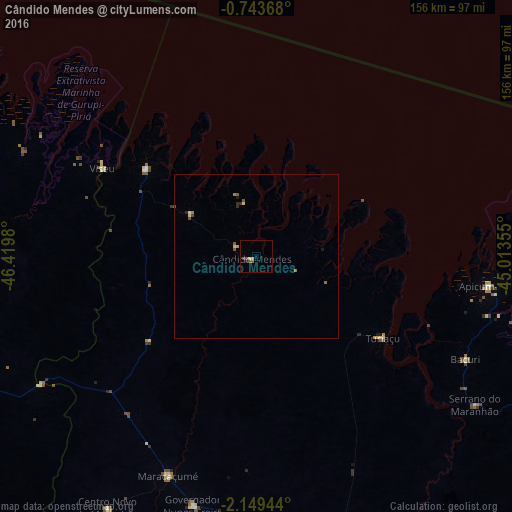
Analysis of Cândido Mendes night lights 2016
Square area 10x10 km:
 0%
0%90-99
0%80-89
1.73%70-79
0%60-69
0%50-59
1.95%40-49
1.08%30-39
0.43%20-29
0.87%10-19
0%0-9
93.94%Square area 50x50 km:
0%90-99
0.03%80-89
0.18%70-79
0.03%60-69
0.14%50-59
0.19%40-49
0.16%30-39
0.02%20-29
0.18%10-19
0.06%0-9
99.01%Clear (daylight) street map image can be seen on geolist.org.
Map coordinates:
0° 44' 37.2" South, 46° 25' 11.3" West
1° 26' 48" South, 45° 43' 0" West
2° 8' 58" South, 45° 0' 48.8" West
Some cities around Cândido Mendes sort by population:
• Bragança
124.5 km =77.4 mi,  290°
290°
• Cururupu
103.4 km =64.2 mi,  114°
114°
• Viseu
54.7 km =34 mi,  300°
300°
• Augusto Corrêa
112.5 km =69.9 mi, 294°
• Santa Helena
98.8 km =61.4 mi,  152°
152°
• Maracaçumé
71.6 km =44.5 mi,  202°
202°
• Carutapera
43.8 km =27.2 mi,  309°
309°
• Turiaçu
45.3 km =28.1 mi,  122°
122°
3403395 (p: 8,613)
Sources (retrieved 2019-11-25):
» Earth at Night: Flat Maps 2012, 2016