Timbaúba night lights from space
Night Light of Timbaúba (Pernambuco) from space (Brazil) Src. Average luminocity for 10x10km area is 23.3701% and for 50x50km: 7.8872%.
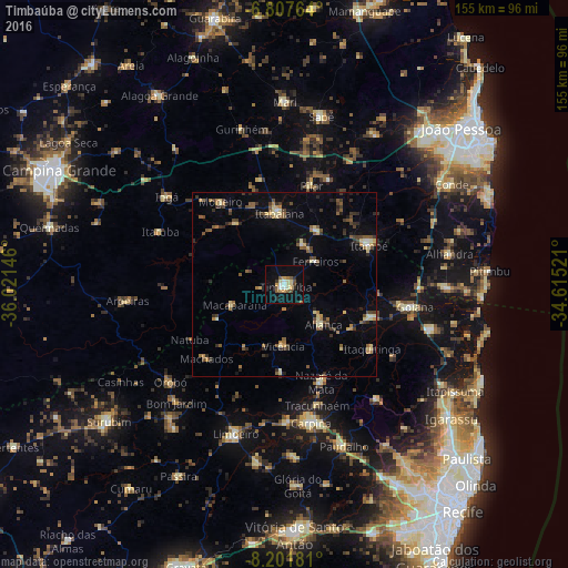
Analysis of Timbaúba night lights 2016
Square area 10x10 km:
 1.95%
1.95%90-99
3.46%80-89
4.76%70-79
2.81%60-69
2.16%50-59
4.33%40-49
2.6%30-39
1.08%20-29
2.6%10-19
19.05%0-9
55.19%Square area 50x50 km:
0.18%90-99
0.53%80-89
1.56%70-79
0.58%60-69
1.01%50-59
1.78%40-49
1.37%30-39
1.42%20-29
1.57%10-19
2.41%0-9
87.59%Clear (daylight) street map image can be seen on geolist.org.
Map coordinates:
6° 48' 27.5" South, 36° 1' 17.3" West
7° 30' 19" South, 35° 19' 6" West
8° 12' 6.5" South, 34° 36' 54.8" West
Some cities around Timbaúba sort by population:
• Nazaré da Mata
28.1 km =17.5 mi,  159°
159°
• Condado
25.1 km =15.6 mi,  110°
110°
• Itabaiana
19.7 km =12.2 mi,  355°
355°
• Macaparana
15.8 km =9.8 mi,  249°
249°
• Pedras de Fogo
25.1 km =15.6 mi,  62°
62°
• Vicência
16.9 km =10.5 mi,  183°
183°
• Juripiranga
17.1 km =10.6 mi,  31°
31°
• Pilar
27.2 km =16.9 mi,  13°
13°
3386396 (p: 45,121)
Sources (retrieved 2019-11-25):
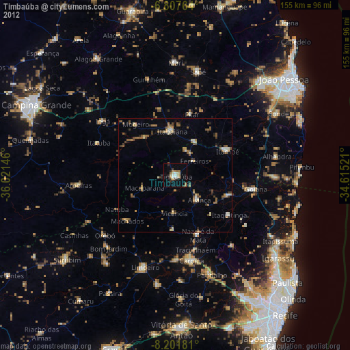
» Earth at Night: Flat Maps 2012, 2016