Macaparana night lights from space
Night Light of Macaparana (Pernambuco) from space (Brazil) Src. Average luminocity for 10x10km area is 6.1645% and for 50x50km: 5.4622%.
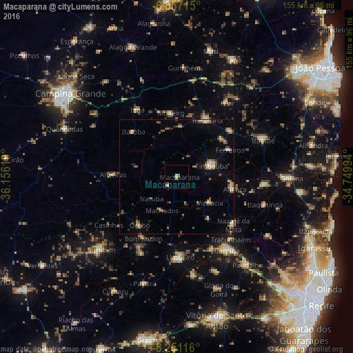
Analysis of Macaparana night lights 2016
Square area 10x10 km:
 0%
0%90-99
0.87%80-89
1.73%70-79
0.22%60-69
1.95%50-59
1.3%40-49
0.22%30-39
1.73%20-29
0.65%10-19
0%0-9
91.34%Square area 50x50 km:
0.13%90-99
0.42%80-89
1.07%70-79
0.39%60-69
0.92%50-59
1.26%40-49
0.8%30-39
0.88%20-29
1.09%10-19
1.49%0-9
91.55%Clear (daylight) street map image can be seen on geolist.org.
Map coordinates:
6° 51' 25.7" South, 36° 9' 22.3" West
7° 33' 17" South, 35° 27' 11" West
8° 15' 4.2" South, 34° 44' 59.8" West
Some cities around Macaparana sort by population:
• Timbaúba
15.8 km =9.8 mi,  69°
69°
• Nazaré da Mata
32.4 km =20.1 mi,  129°
129°
• Itabaiana
28.4 km =17.6 mi,  27°
27°
• Bom Jardim
30.6 km =19 mi,  208°
208°
• Vicência
18 km =11.2 mi, 129°
• Juripiranga
31.1 km =19.3 mi,  49°
49°
• Aroeiras
28.1 km =17.5 mi,  272°
272°
• Orobó
26.8 km =16.7 mi,  217°
217°
3396009 (p: 14,362)
Sources (retrieved 2019-11-25):
» Earth at Night: Flat Maps 2012, 2016