Tijucas night lights from space
Night Light of Tijucas (Santa Catarina) from space (Brazil) Src. Average luminocity for 10x10km area is 31.1345% and for 50x50km: 14.4165%.
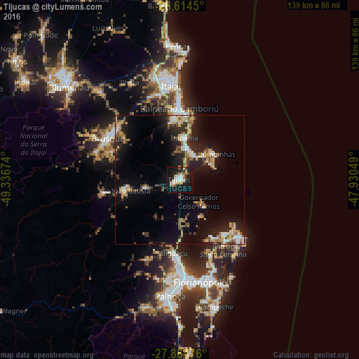
Analysis of Tijucas night lights 2016
Square area 10x10 km:
 5.49%
5.49%90-99
5.11%80-89
4.36%70-79
5.11%60-69
3.03%50-59
1.7%40-49
0.95%30-39
3.22%20-29
5.49%10-19
45.08%0-9
20.45%Square area 50x50 km:
1.75%90-99
1.94%80-89
1.81%70-79
1.99%60-69
1.72%50-59
2%40-49
1.42%30-39
2.4%20-29
4.91%10-19
11.2%0-9
68.88%Clear (daylight) street map image can be seen on geolist.org.
Map coordinates:
26° 36' 52.2" South, 49° 20' 12.3" West
27° 14' 29" South, 48° 38' 1" West
27° 51' 53.1" South, 47° 55' 49.8" West
Some cities around Tijucas sort by population:
• Itajaí
37.2 km =23.1 mi,  355°
355°
• Brusque
31.9 km =19.8 mi,  300°
300°
• Biguaçu
28.2 km =17.5 mi,  184°
184°
• Balneário Camboriú
27.9 km =17.3 mi, 359°
• Navegantes
38.1 km =23.7 mi, 356°
• Itapema
16.9 km =10.5 mi,  7°
7°
• Porto Belo
12.2 km =7.6 mi,  40°
40°
• São João Batista
21.7 km =13.5 mi,  259°
259°
3446500 (p: 22,481)
Sources (retrieved 2019-11-25):
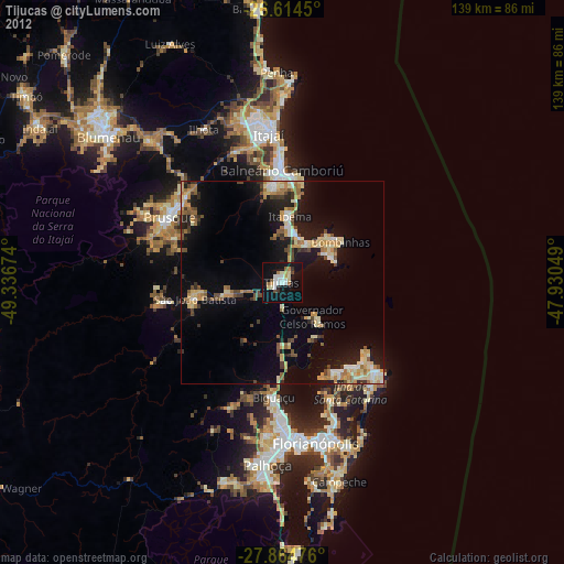
» Earth at Night: Flat Maps 2012, 2016