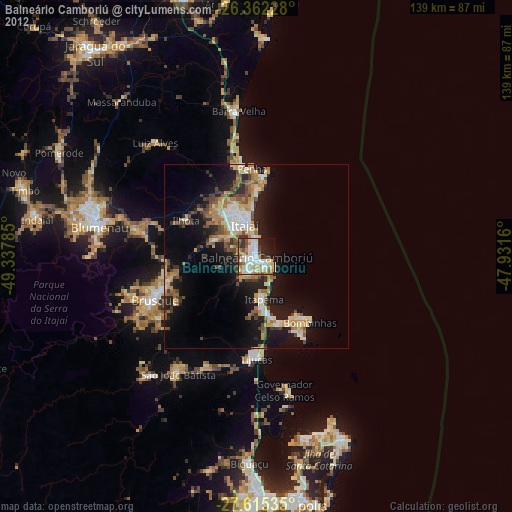
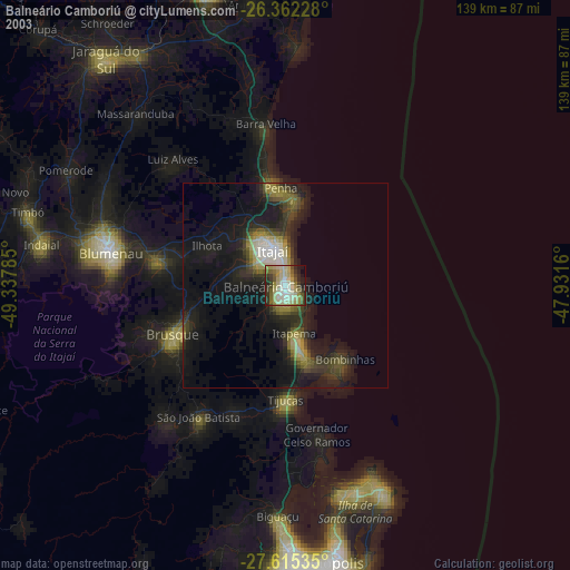
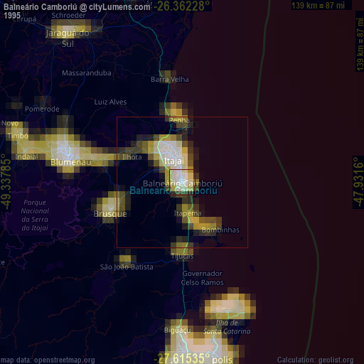
Balneário Camboriú night lights from space
Night Light of Balneário Camboriú (Santa Catarina) from space (Brazil) Src. Average luminocity for 10x10km area is 65.8611% and for 50x50km: 19.2466%.
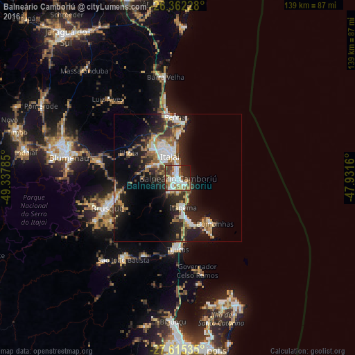
Analysis of Balneário Camboriú night lights 2016
Square area 10x10 km:
 18.85%
90-99
16.27%80-89
6.94%70-79
6.94%60-69
4.96%50-59
11.51%40-49
10.52%30-39
7.94%20-29
11.11%10-19
4.96%0-9
0%Square area 50x50 km:
3.23%90-99
3.17%80-89
2.19%70-79
2.27%60-69
2.33%50-59
3%40-49
2.23%30-39
3.21%20-29
7.06%10-19
11.72%0-9
59.58%Clear (daylight) street map image can be seen on geolist.org.
Map coordinates:
26° 21' 44.2" South, 49° 20' 16.3" West
26° 59' 26" South, 48° 38' 5" West
27° 36' 55.3" South, 47° 55' 53.8" West
Some cities around Balneário Camboriú sort by population:
• Itajaí
9.6 km =6 mi,  343°
343°
• Brusque
30 km =18.6 mi,  246°
246°
• Navegantes
10.4 km =6.5 mi,  349°
349°
• Itapema
11.3 km =7 mi,  168°
168°
• Gaspar
32.8 km =20.4 mi,  281°
281°
• Tijucas
27.9 km =17.3 mi,  179°
179°
• Penha
24.6 km =15.3 mi,  357°
357°
• Porto Belo
20.3 km =12.6 mi,  156°
156°
3471039 (p: 49,100)
Sources (retrieved 2019-11-25):
» NASA, Earths city lights 1995
» NASA city lights 2003
» Earth at Night: Flat Maps 2012, 2016