Navegantes night lights from space
Night Light of Navegantes (Santa Catarina) from space (Brazil) Src. Average luminocity for 10x10km area is 71.3611% and for 50x50km: 18.5277%.
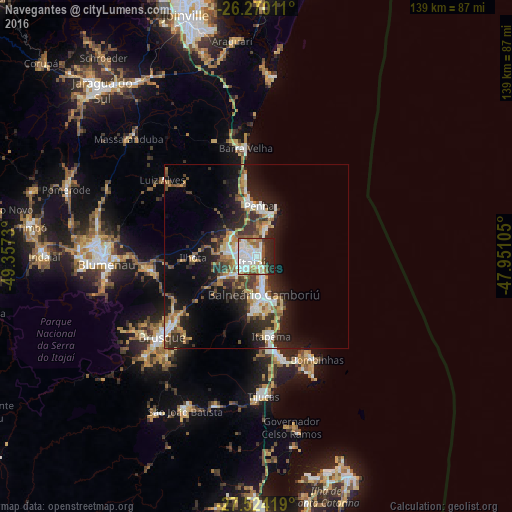
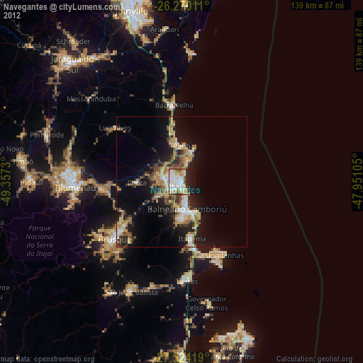
Analysis of Navegantes night lights 2016
Square area 10x10 km:
 24.8%
24.8%90-99
23.61%80-89
5.75%70-79
3.97%60-69
6.75%50-59
8.33%40-49
2.98%30-39
2.58%20-29
16.07%10-19
5.16%0-9
0%Square area 50x50 km:
3.14%90-99
3.11%80-89
1.86%70-79
2.2%60-69
2.34%50-59
3%40-49
2.38%30-39
3.03%20-29
6.2%10-19
10.95%0-9
61.79%Clear (daylight) street map image can be seen on geolist.org.
Map coordinates:
26° 16' 12.4" South, 49° 21' 26.3" West
26° 53' 56" South, 48° 39' 15" West
27° 31' 27.1" South, 47° 57' 3.8" West
Some cities around Navegantes sort by population:
• Itajaí
1.3 km =0.8 mi,  217°
217°
• Brusque
33.9 km =21.1 mi,  229°
229°
• Balneário Camboriú
10.4 km =6.5 mi,  169°
169°
• Itapema
21.7 km =13.5 mi, 168°
• Gaspar
30.4 km =18.9 mi,  263°
263°
• Penha
14.4 km =8.9 mi,  3°
3°
• Barra Velha
29.8 km =18.5 mi,  354°
354°
• Porto Belo
30.5 km =19 mi,  160°
160°
3456370 (p: 47,781)
Sources (retrieved 2019-11-25):
» Earth at Night: Flat Maps 2012, 2016