Ribeirão Preto night lights from space
Night Light of Ribeirão Preto (São Paulo) from space (Brazil) Src. Average luminocity for 10x10km area is 96.9444% and for 50x50km: 18.7%.
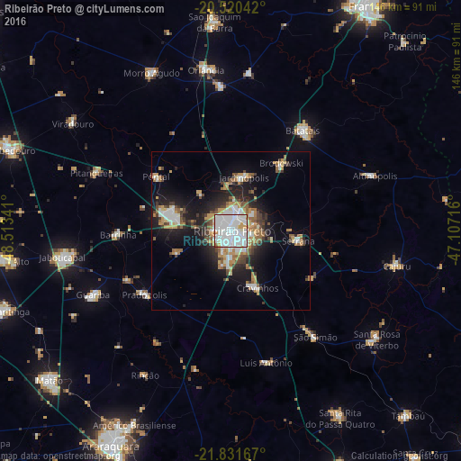

Analysis of Ribeirão Preto night lights 2016
Square area 10x10 km:
 59.33%
90-99
30.75%80-89
2.78%70-79
5.56%60-69
1.59%50-59
0%40-49
0%30-39
0%20-29
0%10-19
0%0-9
0%Square area 50x50 km:
4.18%90-99
3.08%80-89
1.32%70-79
2.81%60-69
2.49%50-59
1.89%40-49
2.27%30-39
2.19%20-29
4.5%10-19
11.03%0-9
64.23%Clear (daylight) street map image can be seen on geolist.org.
Map coordinates:
20° 31' 13.5" South, 48° 30' 48.3" West
21° 10' 39" South, 47° 48' 37" West
21° 49' 54" South, 47° 6' 25.8" West
Some cities around Ribeirão Preto sort by population:
• Sertãozinho
19.2 km =11.9 mi,  283°
283°
• Serrana
22.6 km =14 mi,  99°
99°
• Jardinópolis
18.4 km =11.4 mi,  15°
15°
• Cravinhos
19.9 km =12.4 mi,  155°
155°
• Pontal
29.2 km =18.1 mi,  306°
306°
• Barrinha
36.7 km =22.8 mi,  267°
267°
• Brodósqui
26 km =16.2 mi,  37°
37°
• Pradópolis
33.3 km =20.7 mi,  232°
232°
3451328 (p: 619,746)
Sources (retrieved 2019-11-25):
» NASA, Earths city lights 1995
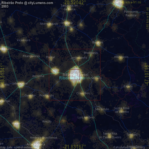
» NASA city lights 2003
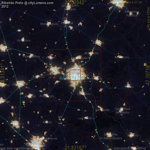
» Earth at Night: Flat Maps 2012, 2016