Pradópolis night lights from space
Night Light of Pradópolis (São Paulo) from space (Brazil) Src. Average luminocity for 10x10km area is 10.1402% and for 50x50km: 8.7141%.
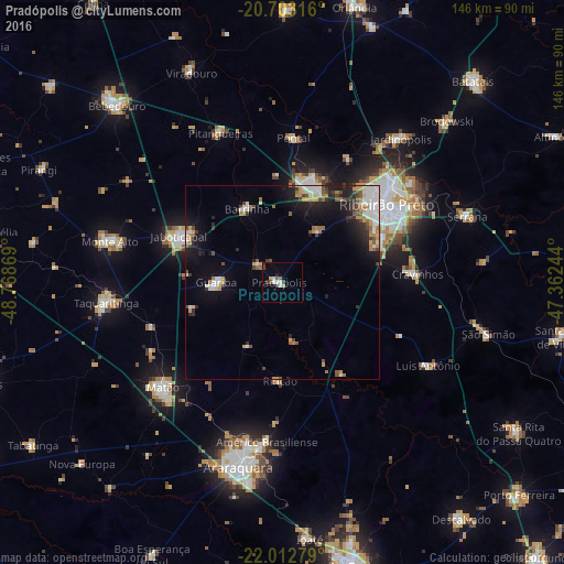
Analysis of Pradópolis night lights 2016
Square area 10x10 km:
 1.89%
1.89%90-99
1.89%80-89
0%70-79
1.52%60-69
0.38%50-59
1.7%40-49
1.7%30-39
1.7%20-29
1.33%10-19
0.38%0-9
87.5%Square area 50x50 km:
1.8%90-99
1.33%80-89
0.54%70-79
1.32%60-69
0.91%50-59
0.89%40-49
1.09%30-39
1.09%20-29
1.93%10-19
5.28%0-9
83.81%Clear (daylight) street map image can be seen on geolist.org.
Map coordinates:
20° 42' 11.4" South, 48° 46' 7.3" West
21° 21' 34" South, 48° 3' 56" West
22° 0' 46" South, 47° 21' 44.8" West
Some cities around Pradópolis sort by population:
• Ribeirão Preto
33.3 km =20.7 mi,  52°
52°
• Sertãozinho
25.9 km =16.1 mi,  17°
17°
• Jaboticabal
29 km =18 mi,  293°
293°
• Américo Brasiliense
40.8 km =25.4 mi,  185°
185°
• Cravinhos
34.9 km =21.7 mi,  86°
86°
• Pontal
37.6 km =23.4 mi,  4°
4°
• Guariba
16.9 km =10.5 mi,  269°
269°
• Barrinha
21.1 km =13.1 mi,  331°
331°
3452478 (p: 13,192)
Sources (retrieved 2019-11-25):
» Earth at Night: Flat Maps 2012, 2016