São João dos Inhamuns night lights from space
Night Light of São João dos Inhamuns (Ceará) from space (Brazil) Src. Average luminocity for 10x10km area is 18.4504% and for 50x50km: 1.0959%.
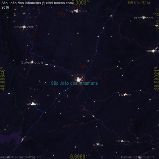
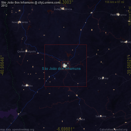
Analysis of São João dos Inhamuns night lights 2016
Square area 10x10 km:
 3.72%
3.72%90-99
5.17%80-89
1.65%70-79
0.21%60-69
0%50-59
2.48%40-49
3.31%30-39
0.83%20-29
3.1%10-19
5.58%0-9
73.97%Square area 50x50 km:
0.15%90-99
0.27%80-89
0.07%70-79
0.02%60-69
0.07%50-59
0.16%40-49
0.17%30-39
0.16%20-29
0.31%10-19
0.27%0-9
98.35%Clear (daylight) street map image can be seen on geolist.org.
Map coordinates:
5° 18' 1.1" South, 40° 59' 11.3" West
6° 0' 0" South, 40° 16' 60" West
6° 41' 55.7" South, 39° 34' 48.8" West
Some cities around São João dos Inhamuns sort by population:
• Crateús
101.2 km =62.9 mi,  334°
334°
• Acopiara
92.5 km =57.5 mi,  96°
96°
• Várzea Alegre
73.1 km =45.4 mi,  351°
351°
• Pedra Branca
87.2 km =54.2 mi,  45°
45°
• Mombaça
78 km =48.5 mi,  68°
68°
• Parambu
51.2 km =31.8 mi,  242°
242°
• Novo Oriente
75 km =46.6 mi,  313°
313°
• Independência
67.2 km =41.8 mi,  357°
357°
3386567 (p: 29,188)
Sources (retrieved 2019-11-25):
» Earth at Night: Flat Maps 2012, 2016