Mombaça night lights from space
Night Light of Mombaça (Ceará) from space (Brazil) Src. Average luminocity for 10x10km area is 9.6405% and for 50x50km: 0.8487%.
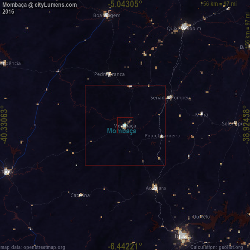
Analysis of Mombaça night lights 2016
Square area 10x10 km:
 1.65%
1.65%90-99
1.65%80-89
0.83%70-79
0.21%60-69
1.45%50-59
2.07%40-49
0.62%30-39
2.69%20-29
2.07%10-19
0%0-9
86.78%Square area 50x50 km:
0.11%90-99
0.16%80-89
0.1%70-79
0.04%60-69
0.12%50-59
0.16%40-49
0.09%30-39
0.23%20-29
0.09%10-19
0.07%0-9
98.82%Clear (daylight) street map image can be seen on geolist.org.
Map coordinates:
5° 2' 35" South, 40° 19' 50.3" West
5° 44' 35" South, 39° 37' 39" West
6° 26' 32" South, 38° 55' 27.8" West
Some cities around Mombaça sort by population:
• Iguatu
77.6 km =48.2 mi,  152°
152°
• Quixeramobim
70.9 km =44.1 mi,  31°
31°
• São João dos Inhamuns
78 km =48.5 mi,  248°
248°
• Boa Viagem
69.4 km =43.1 mi,  350°
350°
• Acopiara
43.7 km =27.2 mi, 153°
• Pedra Branca
33.6 km =20.9 mi,  342°
342°
• Senador Pompeu
33.1 km =20.6 mi,  58°
58°
• Independência
84.7 km =52.6 mi,  297°
297°
3394649 (p: 17,065)
Sources (retrieved 2019-11-25):
» Earth at Night: Flat Maps 2012, 2016