Salinas night lights from space
Night Light of Salinas (Minas Gerais) from space (Brazil) Src. Average luminocity for 10x10km area is 24.3037% and for 50x50km: 1.4635%.
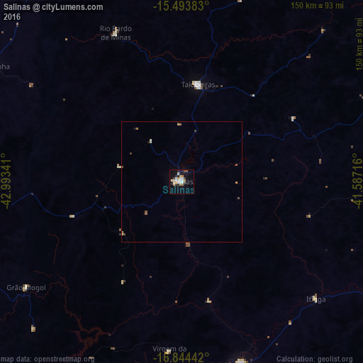
Analysis of Salinas night lights 2016
Square area 10x10 km:
 5.79%
5.79%90-99
3.93%80-89
2.69%70-79
3.1%60-69
1.86%50-59
1.65%40-49
3.1%30-39
1.45%20-29
2.89%10-19
18.6%0-9
54.96%Square area 50x50 km:
0.23%90-99
0.19%80-89
0.21%70-79
0.18%60-69
0.18%50-59
0.13%40-49
0.26%30-39
0.09%20-29
0.17%10-19
0.79%0-9
97.57%Clear (daylight) street map image can be seen on geolist.org.
Map coordinates:
15° 29' 37.8" South, 42° 59' 36.3" West
16° 10' 13" South, 42° 17' 25" West
16° 50' 39.9" South, 41° 35' 13.8" West
Some cities around Salinas sort by population:
• Taiobeiras
40.8 km =25.4 mi,  8°
8°
• Araçuaí
79.1 km =49.2 mi,  162°
162°
• Águas Vermelhas
100.5 km =62.4 mi,  62°
62°
• Medina
87 km =54.1 mi,  93°
93°
• Porteirinha
92.1 km =57.2 mi,  301°
301°
• Rio Pardo de Minas
67.8 km =42.1 mi,  336°
336°
• São João do Paraíso
99.7 km =62 mi,  17°
17°
• Mato Verde
105.8 km =65.7 mi,  324°
324°
3450671 (p: 25,746)
Sources (retrieved 2019-11-25):
» Earth at Night: Flat Maps 2012, 2016