Palmas de Monte Alto night lights from space
Night Light of Palmas de Monte Alto (Bahia) from space (Brazil) Src. Average luminocity for 10x10km area is 9.3052% and for 50x50km: 0.5794%.
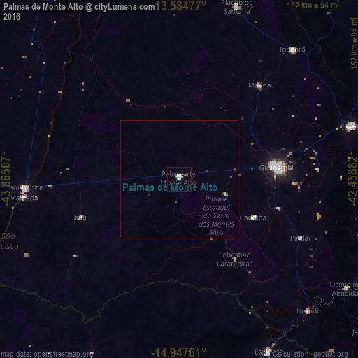
Analysis of Palmas de Monte Alto night lights 2016
Square area 10x10 km:
 2.16%
2.16%90-99
3.03%80-89
0.87%70-79
0%60-69
1.52%50-59
0.22%40-49
0%30-39
0.87%20-29
0.87%10-19
0%0-9
90.48%Square area 50x50 km:
0.11%90-99
0.16%80-89
0.03%70-79
0%60-69
0.09%50-59
0.01%40-49
0.13%30-39
0.08%20-29
0.11%10-19
0.06%0-9
99.23%Clear (daylight) street map image can be seen on geolist.org.
Map coordinates:
13° 35' 5.2" South, 43° 51' 54.3" West
14° 16' 2" South, 43° 9' 43" West
14° 56' 51.4" South, 42° 27' 31.8" West
Some cities around Palmas de Monte Alto sort by population:
• Guanambi
41.3 km =25.7 mi,  83°
83°
• Caetité
77.3 km =48 mi,  73°
73°
• Espinosa
82 km =51 mi,  153°
153°
• Riacho de Santana
77 km =47.8 mi,  18°
18°
• Caculé
104.6 km =65 mi,  104°
104°
• Manga
99.1 km =61.6 mi,  236°
236°
• Carinhanha
65.1 km =40.5 mi,  266°
266°
• Monte Azul
103.4 km =64.2 mi,  162°
162°
3455447 (p: 7,091)
Sources (retrieved 2019-11-25):
» Earth at Night: Flat Maps 2012, 2016