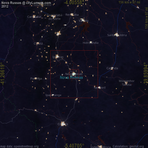
Nova Russas night lights from space
Night Light of Nova Russas (Ceará) from space (Brazil) Src. Average luminocity for 10x10km area is 15.7231% and for 50x50km: 2.0315%.
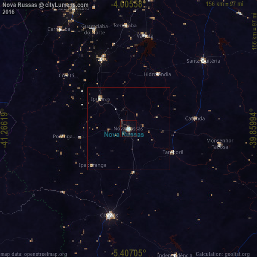
Analysis of Nova Russas night lights 2016
Square area 10x10 km:
 2.07%
2.07%90-99
4.55%80-89
0.41%70-79
0%60-69
0.83%50-59
3.51%40-49
2.27%30-39
2.89%20-29
3.51%10-19
1.24%0-9
78.72%Square area 50x50 km:
0.1%90-99
0.39%80-89
0.24%70-79
0.26%60-69
0.13%50-59
0.46%40-49
0.22%30-39
0.36%20-29
0.45%10-19
0.24%0-9
97.14%Clear (daylight) street map image can be seen on geolist.org.
Map coordinates:
4° 0' 20.1" South, 41° 15' 58.3" West
4° 42' 24" South, 40° 33' 47" West
5° 24' 25.4" South, 39° 51' 35.8" West
Some cities around Nova Russas sort by population:
• Crateús
54 km =33.6 mi,  193°
193°
• Ipu
45.8 km =28.5 mi,  339°
339°
• Santa Quitéria
61.4 km =38.2 mi,  47°
47°
• Guaraciaba do Norte
63.4 km =39.4 mi, 341°
• Varjota
57.8 km =35.9 mi,  9°
9°
• Tamboril
30.3 km =18.8 mi,  117°
117°
• Reriutaba
62.9 km =39.1 mi,  358°
358°
• Hidrolândia
36 km =22.4 mi,  22°
22°
3393832 (p: 21,986)
Sources (retrieved 2019-11-25):
» Earth at Night: Flat Maps 2012, 2016