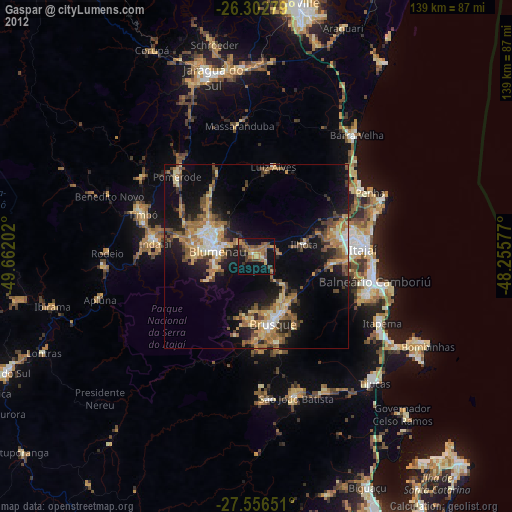
Gaspar night lights from space
Night Light of Gaspar (Santa Catarina) from space (Brazil) Src. Average luminocity for 10x10km area is 27.9544% and for 50x50km: 19.9585%.
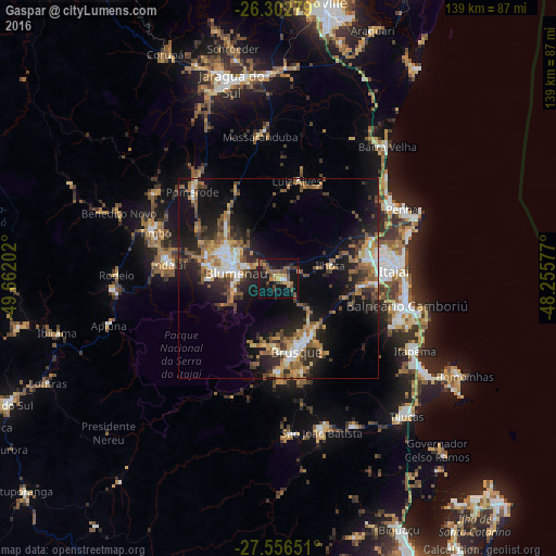
Analysis of Gaspar night lights 2016
Square area 10x10 km:
 0%
0%90-99
1.59%80-89
2.78%70-79
4.56%60-69
4.96%50-59
9.52%40-49
6.35%30-39
6.15%20-29
4.37%10-19
35.71%0-9
24.01%Square area 50x50 km:
1.92%90-99
2.65%80-89
1.82%70-79
2.83%60-69
3.51%50-59
4.03%40-49
2.88%30-39
3.56%20-29
6.31%10-19
14.99%0-9
55.49%Clear (daylight) street map image can be seen on geolist.org.
Map coordinates:
26° 18' 10" South, 49° 39' 43.3" West
26° 55' 53" South, 48° 57' 32" West
27° 33' 23.4" South, 48° 15' 20.8" West
Some cities around Gaspar sort by population:
• Blumenau
10.7 km =6.6 mi,  277°
277°
• Itajaí
29.6 km =18.4 mi,  84°
84°
• Brusque
19.1 km =11.9 mi,  166°
166°
• Balneário Camboriú
32.8 km =20.4 mi,  101°
101°
• Navegantes
30.4 km =18.9 mi, 83°
• Indaial
27.3 km =17 mi, 277°
• Timbó
33.3 km =20.7 mi,  291°
291°
• Pomerode
30.3 km =18.8 mi,  314°
314°
3462535 (p: 33,658)
Sources (retrieved 2019-11-25):
» Earth at Night: Flat Maps 2012, 2016