Catanduva night lights from space
Night Light of Catanduva (São Paulo) from space (Brazil) Src. Average luminocity for 10x10km area is 56.2361% and for 50x50km: 6.3838%.
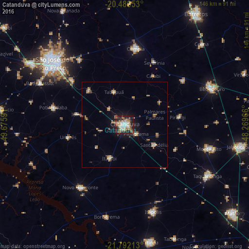
Analysis of Catanduva night lights 2016
Square area 10x10 km:
 10.91%
90-99
10.91%80-89
5.36%70-79
10.32%60-69
10.91%50-59
7.74%40-49
5.95%30-39
5.16%20-29
19.64%10-19
13.1%0-9
0%Square area 50x50 km:
0.6%90-99
0.72%80-89
0.53%70-79
1.4%60-69
1.33%50-59
0.72%40-49
0.85%30-39
0.49%20-29
1.29%10-19
3.53%0-9
88.54%Clear (daylight) street map image can be seen on geolist.org.
Map coordinates:
20° 28' 49.9" South, 49° 40' 33.3" West
21° 8' 16" South, 48° 58' 22" West
21° 47' 31.7" South, 48° 16' 10.8" West
Some cities around Catanduva sort by population:
• Olímpia
44.9 km =27.9 mi,  7°
7°
• Novo Horizonte
44.8 km =27.8 mi,  214°
214°
• Monte Azul Paulista
42.9 km =26.7 mi,  53°
53°
• Severínia
40.6 km =25.2 mi,  25°
25°
• Santa Adélia
21 km =13 mi,  123°
123°
• Pindorama
8.6 km =5.3 mi,  128°
128°
• Itajobi
21.8 km =13.5 mi,  202°
202°
• Urupês
33.6 km =20.9 mi,  257°
257°
3466692 (p: 109,612)
Sources (retrieved 2019-11-25):
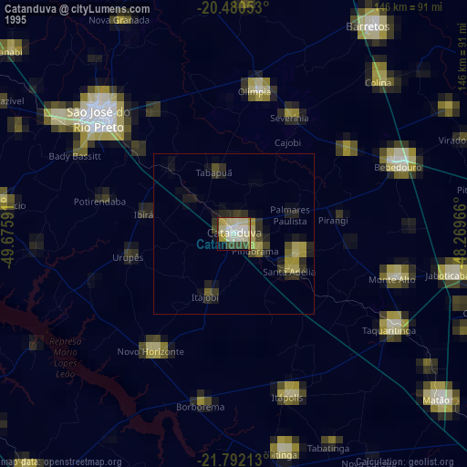
» NASA, Earths city lights 1995
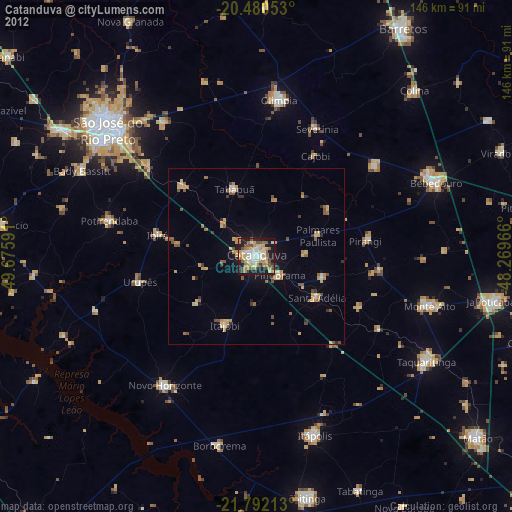
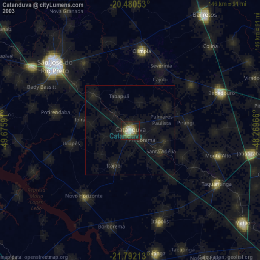
» NASA city lights 2003
» Earth at Night: Flat Maps 2012, 2016