Santa Adélia night lights from space
Night Light of Santa Adélia (São Paulo) from space (Brazil) Src. Average luminocity for 10x10km area is 11.0159% and for 50x50km: 5.6165%.
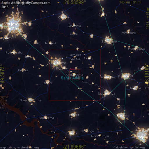
Analysis of Santa Adélia night lights 2016
Square area 10x10 km:
 0.79%
0.79%90-99
1.59%80-89
0.2%70-79
2.98%60-69
3.17%50-59
1.59%40-49
1.39%30-39
0.2%20-29
0%10-19
0.79%0-9
87.3%Square area 50x50 km:
0.55%90-99
0.63%80-89
0.48%70-79
1.08%60-69
1.19%50-59
0.66%40-49
0.75%30-39
0.71%20-29
1.1%10-19
3.27%0-9
89.56%Clear (daylight) street map image can be seen on geolist.org.
Map coordinates:
20° 35' 9.6" South, 49° 30' 26.3" West
21° 14' 34" South, 48° 48' 15" West
21° 53' 48" South, 48° 6' 3.8" West
Some cities around Santa Adélia sort by population:
• Catanduva
21 km =13 mi,  303°
303°
• Bebedouro
46.9 km =29.1 mi,  45°
45°
• Taquaritinga
35.9 km =22.3 mi,  120°
120°
• Monte Alto
32 km =19.9 mi,  93°
93°
• Itápolis
39.2 km =24.4 mi,  181°
181°
• Monte Azul Paulista
41 km =25.5 mi,  24°
24°
• Pindorama
12.4 km =7.7 mi, 300°
• Itajobi
27.2 km =16.9 mi,  252°
252°
3450464 (p: 12,585)
Sources (retrieved 2019-11-25):
» Earth at Night: Flat Maps 2012, 2016