Barretos night lights from space
Night Light of Barretos (São Paulo) from space (Brazil) Src. Average luminocity for 10x10km area is 51.2708% and for 50x50km: 3.7182%.
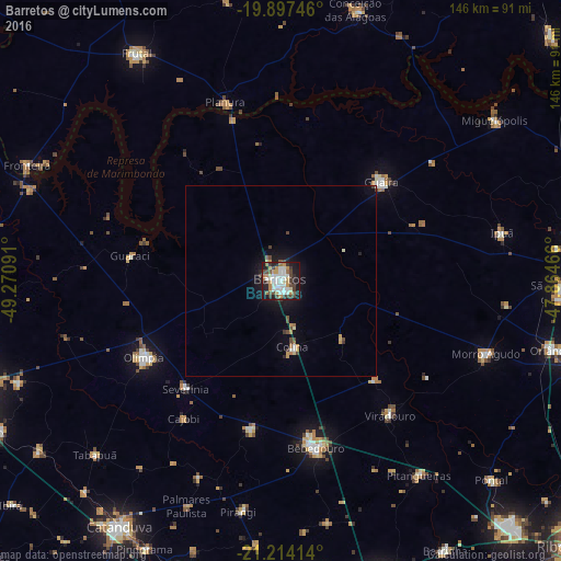
Analysis of Barretos night lights 2016
Square area 10x10 km:
 11.93%
90-99
11.17%80-89
3.03%70-79
10.23%60-69
5.68%50-59
1.89%40-49
10.61%30-39
7.58%20-29
11.17%10-19
25.38%0-9
1.33%Square area 50x50 km:
0.56%90-99
0.57%80-89
0.24%70-79
0.67%60-69
0.38%50-59
0.18%40-49
0.85%30-39
0.45%20-29
0.56%10-19
2.9%0-9
92.64%Clear (daylight) street map image can be seen on geolist.org.
Map coordinates:
19° 53' 50.9" South, 49° 16' 15.3" West
20° 33' 26" South, 48° 34' 4" West
21° 12' 50.9" South, 47° 51' 52.8" West
Some cities around Barretos sort by population:
• Bebedouro
44.6 km =27.7 mi,  168°
168°
• Olímpia
41.3 km =25.7 mi,  240°
240°
• Guaíra
37.7 km =23.4 mi,  45°
45°
• Morro Agudo
56.5 km =35.1 mi,  110°
110°
• Monte Azul Paulista
39.7 km =24.7 mi,  191°
191°
• Viradouro
45 km =28 mi,  141°
141°
• Severínia
37.2 km =23.1 mi,  221°
221°
• Ipuã
59.4 km =36.9 mi,  77°
77°
3470451 (p: 101,220)
Sources (retrieved 2019-11-25):
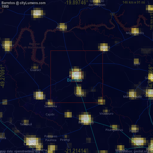
» NASA, Earths city lights 1995
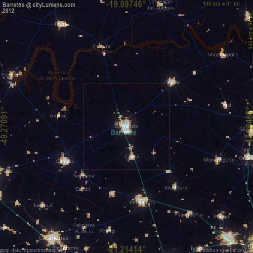
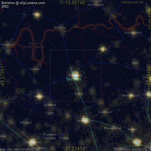
» NASA city lights 2003
» Earth at Night: Flat Maps 2012, 2016