Miracema do Tocantins night lights from space
Night Light of Miracema do Tocantins (Tocantins) from space (Brazil) Src. Average luminocity for 10x10km area is 22.4848% and for 50x50km: 1.628%.
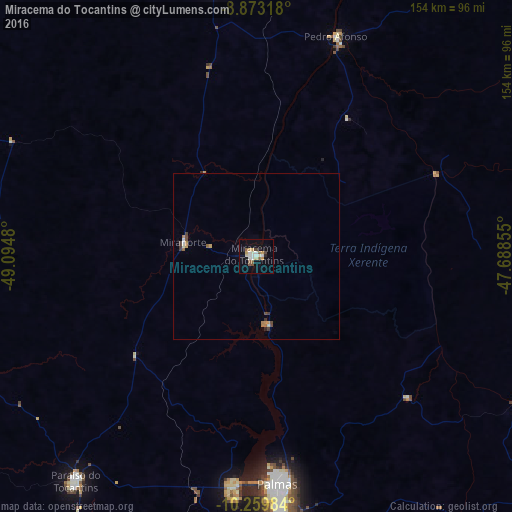
Analysis of Miracema do Tocantins night lights 2016
Square area 10x10 km:
 2.81%
2.81%90-99
5.63%80-89
2.38%70-79
3.9%60-69
0%50-59
5.19%40-49
1.73%30-39
0.87%20-29
0.87%10-19
12.34%0-9
64.29%Square area 50x50 km:
0.13%90-99
0.34%80-89
0.09%70-79
0.3%60-69
0.2%50-59
0.24%40-49
0.27%30-39
0.24%20-29
0.07%10-19
0.48%0-9
97.65%Clear (daylight) street map image can be seen on geolist.org.
Map coordinates:
8° 52' 23.4" South, 49° 5' 41.3" West
9° 34' 2" South, 48° 23' 30" West
10° 15' 35.4" South, 47° 41' 18.8" West
Some cities around Miracema do Tocantins sort by population:
• Palmas
67.1 km =41.7 mi,  174°
174°
• Araguaína
265 km =164.7 mi,  4°
4°
• Redenção
248.5 km =154.4 mi,  313°
313°
• Gurupi
251.5 km =156.3 mi,  197°
197°
• Conceição do Araguaia
174 km =108.1 mi,  326°
326°
• Santa Luzia
249.9 km =155.3 mi,  31°
31°
• Carolina
268.4 km =166.8 mi,  22°
22°
• Santa Terezinha
253.1 km =157.3 mi,  246°
246°
3394817 (p: 19,634)
Sources (retrieved 2019-11-25):
» Earth at Night: Flat Maps 2012, 2016