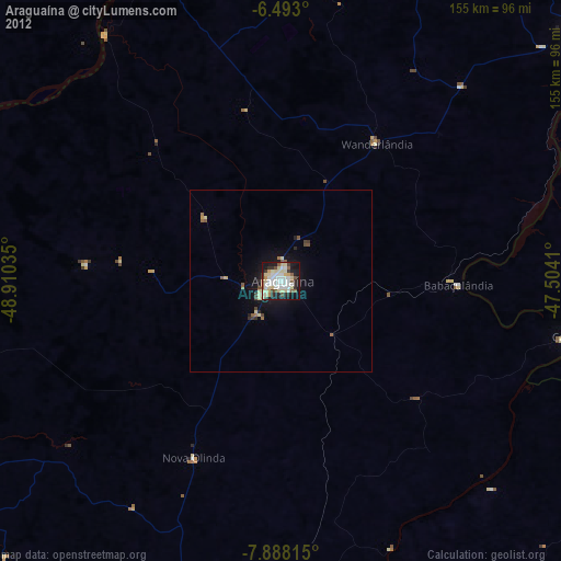
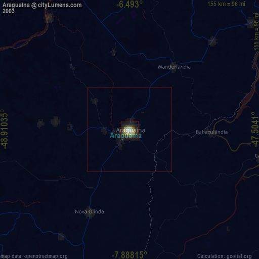
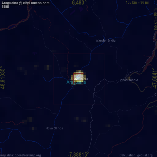
Araguaína night lights from space
Night Light of Araguaína (Tocantins) from space (Brazil) Src. Average luminocity for 10x10km area is 67.4069% and for 50x50km: 4.5157%.
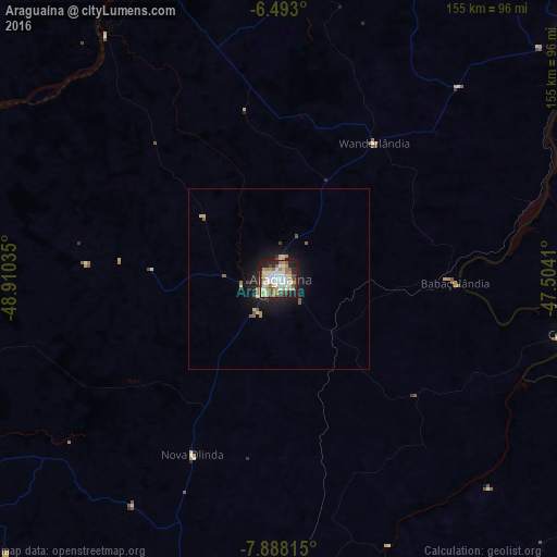
Analysis of Araguaína night lights 2016
Square area 10x10 km:
 14.5%
14.5%90-99
21.65%80-89
10.39%70-79
7.14%60-69
8.66%50-59
6.93%40-49
7.79%30-39
2.16%20-29
13.42%10-19
7.36%0-9
0%Square area 50x50 km:
0.58%90-99
0.92%80-89
0.71%70-79
0.39%60-69
0.55%50-59
0.61%40-49
0.47%30-39
0.28%20-29
1.18%10-19
3.8%0-9
90.52%Clear (daylight) street map image can be seen on geolist.org.
Map coordinates:
6° 29' 34.8" South, 48° 54' 37.3" West
7° 11' 28" South, 48° 12' 26" West
7° 53' 17.3" South, 47° 30' 14.8" West
Some cities around Araguaína sort by population:
• Xinguara
191.8 km =119.2 mi,  273°
273°
• Conceição do Araguaia
167.2 km =103.9 mi,  224°
224°
• Santa Luzia
120.1 km =74.6 mi,  114°
114°
• Carolina
83.7 km =52 mi,  101°
101°
• Porto Franco
130.2 km =80.9 mi,  43°
43°
• São Geraldo do Araguaia
95.9 km =59.6 mi,  336°
336°
• Riachão
176.4 km =109.6 mi, 96°
• Bom Jardim
191.2 km =118.8 mi,  84°
84°
3407357 (p: 105,019)
Sources (retrieved 2019-11-25):
» NASA, Earths city lights 1995
» NASA city lights 2003
» Earth at Night: Flat Maps 2012, 2016