Matipó night lights from space
Night Light of Matipó (Minas Gerais) from space (Brazil) Src. Average luminocity for 10x10km area is 6.9563% and for 50x50km: 1.8233%.
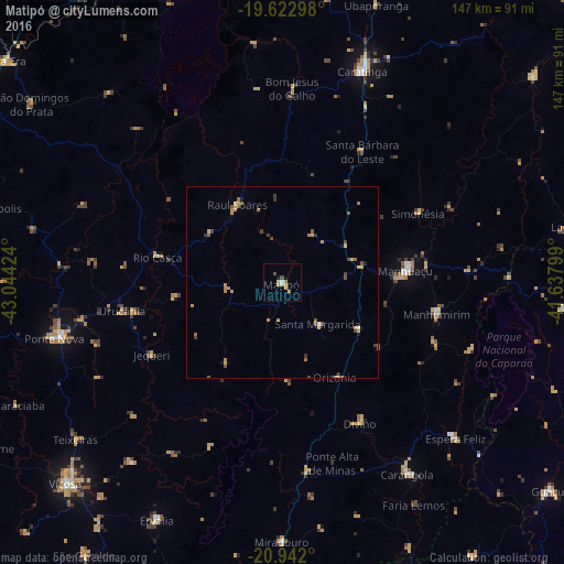
Analysis of Matipó night lights 2016
Square area 10x10 km:
 0.4%
0.4%90-99
0.4%80-89
1.59%70-79
2.78%60-69
1.19%50-59
0.2%40-49
1.39%30-39
0%20-29
0%10-19
0.79%0-9
91.27%Square area 50x50 km:
0.04%90-99
0.06%80-89
0.29%70-79
0.48%60-69
0.53%50-59
0.34%40-49
0.41%30-39
0.28%20-29
0.09%10-19
0.18%0-9
97.29%Clear (daylight) street map image can be seen on geolist.org.
Map coordinates:
19° 37' 22.7" South, 43° 2' 39.3" West
20° 17' 2" South, 42° 20' 28" West
20° 56' 31.2" South, 41° 38' 16.8" West
Some cities around Matipó sort by population:
• Caratinga
58.9 km =36.6 mi,  21°
21°
• Manhuaçu
32.2 km =20 mi,  84°
84°
• Ponte Nova
61 km =37.9 mi,  256°
256°
• Carangola
59.6 km =37 mi,  146°
146°
• Manhumirim
40.8 km =25.4 mi,  101°
101°
• Espera Feliz
60.8 km =37.8 mi,  132°
132°
• Bom Jesus do Galho
50.7 km =31.5 mi,  2°
2°
• Rio Casca
32.9 km =20.4 mi,  281°
281°
3457454 (p: 12,996)
Sources (retrieved 2019-11-25):
» Earth at Night: Flat Maps 2012, 2016