Espera Feliz night lights from space
Night Light of Espera Feliz (Minas Gerais) from space (Brazil) Src. Average luminocity for 10x10km area is 6.7595% and for 50x50km: 2.2803%.
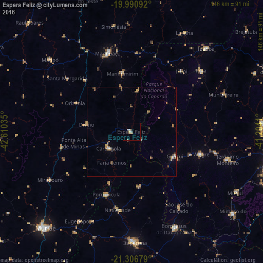
Analysis of Espera Feliz night lights 2016
Square area 10x10 km:
 0.76%
0.76%90-99
1.52%80-89
1.33%70-79
0.95%60-69
0.76%50-59
1.52%40-49
0%30-39
0%20-29
0.76%10-19
0%0-9
92.42%Square area 50x50 km:
0.19%90-99
0.22%80-89
0.29%70-79
0.61%60-69
0.36%50-59
0.36%40-49
0.38%30-39
0.24%20-29
0.22%10-19
0.17%0-9
96.96%Clear (daylight) street map image can be seen on geolist.org.
Map coordinates:
19° 59' 27.3" South, 42° 36' 37.3" West
20° 39' 1" South, 41° 54' 26" West
21° 18' 24.4" South, 41° 12' 14.8" West
Some cities around Espera Feliz sort by population:
• Manhuaçu
45.6 km =28.3 mi,  343°
343°
• Carangola
15.7 km =9.8 mi,  234°
234°
• Guaçuí
27.5 km =17.1 mi,  120°
120°
• Alegre
40.9 km =25.4 mi,  107°
107°
• Manhumirim
33 km =20.5 mi,  350°
350°
• Porciúncula
37.4 km =23.2 mi,  201°
201°
• Natividade
44.1 km =27.4 mi,  188°
188°
• São José do Calçado
49.3 km =30.6 mi,  147°
147°
3463993 (p: 13,030)
Sources (retrieved 2019-11-25):
» Earth at Night: Flat Maps 2012, 2016