Malacacheta night lights from space
Night Light of Malacacheta (Minas Gerais) from space (Brazil) Src. Average luminocity for 10x10km area is 6.8268% and for 50x50km: 0.4696%.
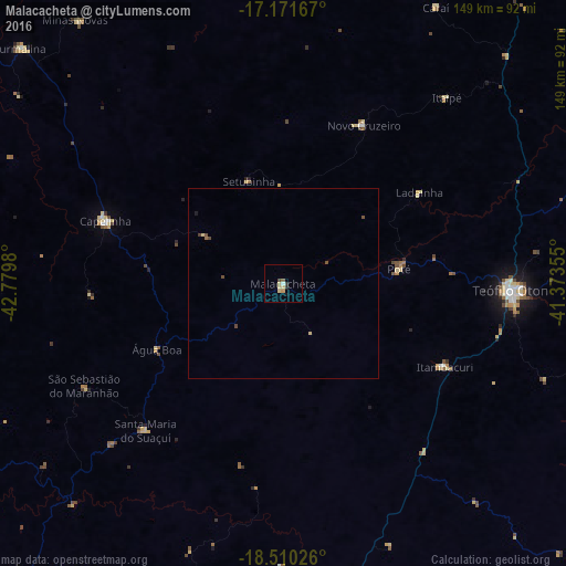
Analysis of Malacacheta night lights 2016
Square area 10x10 km:
 0%
0%90-99
0.87%80-89
3.46%70-79
0.87%60-69
0%50-59
0.87%40-49
0.87%30-39
0.87%20-29
0.87%10-19
0.87%0-9
90.48%Square area 50x50 km:
0%90-99
0.03%80-89
0.2%70-79
0.03%60-69
0.03%50-59
0.05%40-49
0.21%30-39
0.07%20-29
0.03%10-19
0.07%0-9
99.28%Clear (daylight) street map image can be seen on geolist.org.
Map coordinates:
17° 10' 18" South, 42° 46' 47.3" West
17° 50' 32" South, 42° 4' 36" West
18° 30' 36.9" South, 41° 22' 24.8" West
Some cities around Malacacheta sort by population:
• Teófilo Otoni
60.5 km =37.6 mi,  91°
91°
• Capelinha
49.4 km =30.7 mi,  289°
289°
• Itamarandiba
82.8 km =51.4 mi,  268°
268°
• Itambacuri
46.5 km =28.9 mi,  116°
116°
• Novo Cruzeiro
46.8 km =29.1 mi,  27°
27°
• Santa Maria do Suaçuí
52.6 km =32.7 mi,  222°
222°
• Minas Novas
88.2 km =54.8 mi,  321°
321°
• Caraí
83.2 km =51.7 mi, 29°
3458121 (p: 8,819)
Sources (retrieved 2019-11-25):
» Earth at Night: Flat Maps 2012, 2016