Santa Maria do Suaçuí night lights from space
Night Light of Santa Maria do Suaçuí (Minas Gerais) from space (Brazil) Src. Average luminocity for 10x10km area is 5.2056% and for 50x50km: 0.6355%.
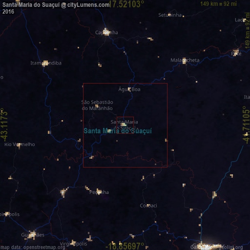
Analysis of Santa Maria do Suaçuí night lights 2016
Square area 10x10 km:
 0%
0%90-99
0%80-89
2.38%70-79
1.95%60-69
0%50-59
0.87%40-49
0%30-39
0.87%20-29
0.87%10-19
0%0-9
93.07%Square area 50x50 km:
0%90-99
0%80-89
0.17%70-79
0.14%60-69
0.12%50-59
0.18%40-49
0.17%30-39
0.16%20-29
0.1%10-19
0%0-9
98.97%Clear (daylight) street map image can be seen on geolist.org.
Map coordinates:
17° 31' 15.7" South, 43° 7' 2.3" West
18° 11' 25" South, 42° 24' 51" West
18° 51' 25.1" South, 41° 42' 39.8" West
Some cities around Santa Maria do Suaçuí sort by population:
• Governador Valadares
88.3 km =54.9 mi,  146°
146°
• Guanhães
84.9 km =52.8 mi,  220°
220°
• Capelinha
56.5 km =35.1 mi,  349°
349°
• Itamarandiba
59.9 km =37.2 mi,  308°
308°
• Itambacuri
79.1 km =49.2 mi,  77°
77°
• São João Evangelista
54.2 km =33.7 mi, 222°
• Malacacheta
52.6 km =32.7 mi,  42°
42°
• Peçanha
42.6 km =26.5 mi,  200°
200°
3450057 (p: 9,936)
Sources (retrieved 2019-11-25):
» Earth at Night: Flat Maps 2012, 2016