Joinville night lights from space
Night Light of Joinville (Santa Catarina) from space (Brazil) Src. Average luminocity for 10x10km area is 92.0258% and for 50x50km: 19.696%.
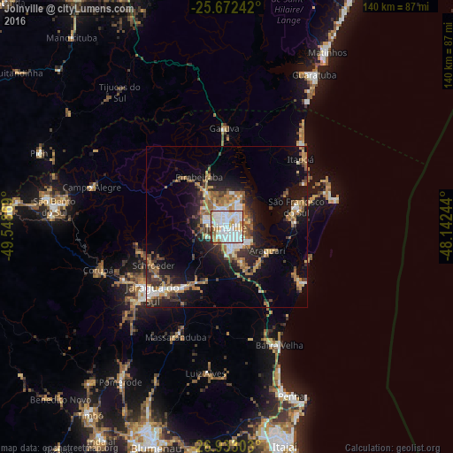
Analysis of Joinville night lights 2016
Square area 10x10 km:
 40.08%
90-99
35.71%80-89
7.14%70-79
8.93%60-69
3.77%50-59
1.39%40-49
1.98%30-39
0.79%20-29
0.2%10-19
0%0-9
0%Square area 50x50 km:
3.2%90-99
3.23%80-89
1.84%70-79
2.59%60-69
3.12%50-59
3.54%40-49
2%30-39
2.71%20-29
4.85%10-19
11.58%0-9
61.35%Clear (daylight) street map image can be seen on geolist.org.
Map coordinates:
25° 40' 20.7" South, 49° 32' 55.3" West
26° 18' 16" South, 48° 50' 44" West
26° 55' 58.9" South, 48° 8' 32.8" West
Some cities around Joinville sort by population:
• Jaraguá do Sul
29.9 km =18.6 mi,  227°
227°
• São Bento do Sul
53.5 km =33.2 mi,  276°
276°
• São Francisco do Sul
21.8 km =13.5 mi,  71°
71°
• Guaramirim
24.4 km =15.2 mi,  219°
219°
• Guaratuba
54.1 km =33.6 mi,  29°
29°
• Barra Velha
39.8 km =24.7 mi,  156°
156°
• Schroeder
25.7 km =16 mi,  242°
242°
• Corupá
41.8 km =26 mi,  251°
251°
3459712 (p: 461,304)
Sources (retrieved 2019-11-25):
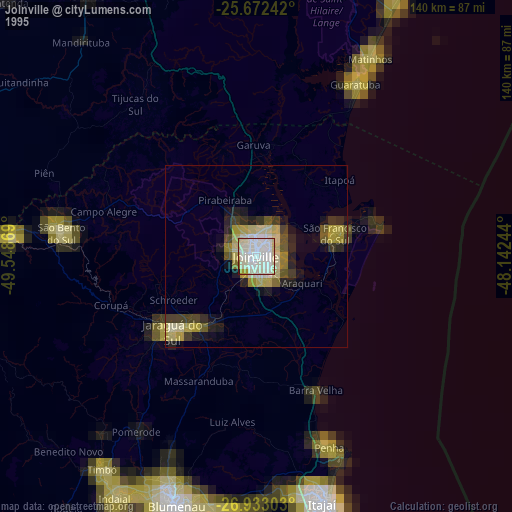
» NASA, Earths city lights 1995
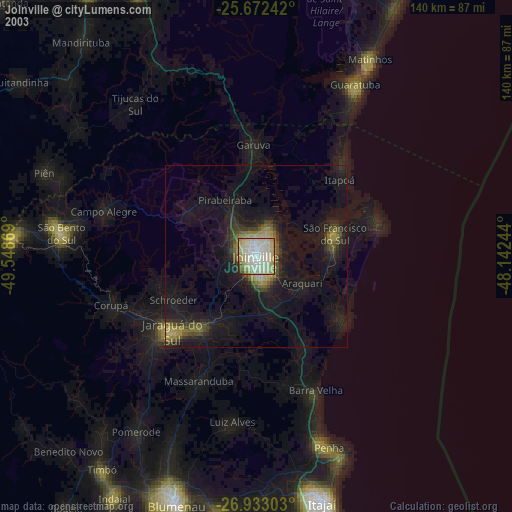
» NASA city lights 2003
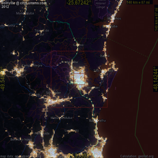
» Earth at Night: Flat Maps 2012, 2016