Jaraguá do Sul night lights from space
Night Light of Jaraguá do Sul (Santa Catarina) from space (Brazil) Src. Average luminocity for 10x10km area is 57.3466% and for 50x50km: 13.9912%.
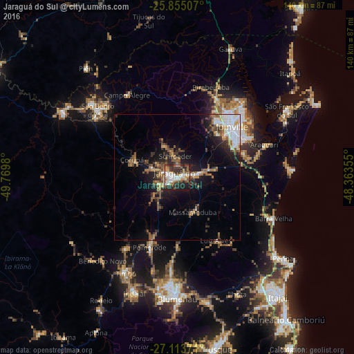
Analysis of Jaraguá do Sul night lights 2016
Square area 10x10 km:
 11.74%
90-99
15.53%80-89
4.17%70-79
7.95%60-69
5.11%50-59
9.09%40-49
7.39%30-39
12.31%20-29
17.8%10-19
8.71%0-9
0.19%Square area 50x50 km:
2.22%90-99
2.38%80-89
0.92%70-79
1.43%60-69
2.05%50-59
2.84%40-49
1.92%30-39
2.31%20-29
3.67%10-19
7.96%0-9
72.3%Clear (daylight) street map image can be seen on geolist.org.
Map coordinates:
25° 51' 18.3" South, 49° 46' 11.3" West
26° 29' 10" South, 49° 4' 0" West
27° 6' 49.4" South, 48° 21' 48.8" West
Some cities around Jaraguá do Sul sort by population:
• Joinville
29.9 km =18.6 mi,  47°
47°
• São Bento do Sul
40.7 km =25.3 mi,  310°
310°
• Timbó
42.7 km =26.5 mi,  208°
208°
• Pomerode
30.3 km =18.8 mi,  201°
201°
• Guaramirim
6.5 km =4 mi,  77°
77°
• Barra Velha
41.3 km =25.7 mi,  113°
113°
• Schroeder
8.2 km =5.1 mi,  355°
355°
• Corupá
18.8 km =11.7 mi,  291°
291°
3460102 (p: 130,130)
Sources (retrieved 2019-11-25):
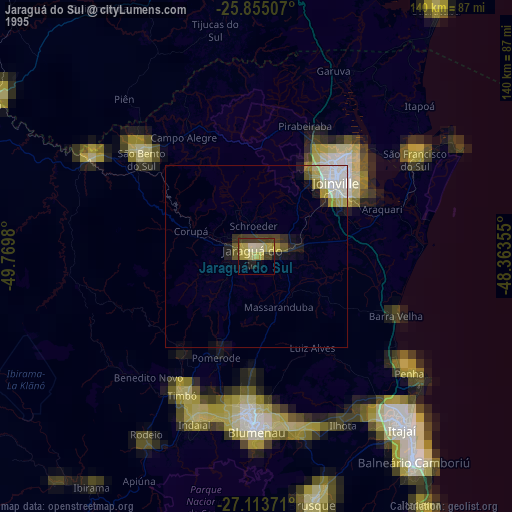
» NASA, Earths city lights 1995
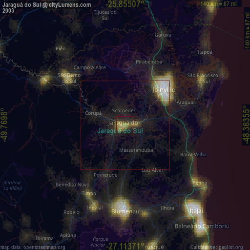
» NASA city lights 2003
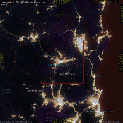
» Earth at Night: Flat Maps 2012, 2016