Guaratuba night lights from space
Night Light of Guaratuba (Paraná) from space (Brazil) Src. Average luminocity for 10x10km area is 34.6894% and for 50x50km: 5.466%.
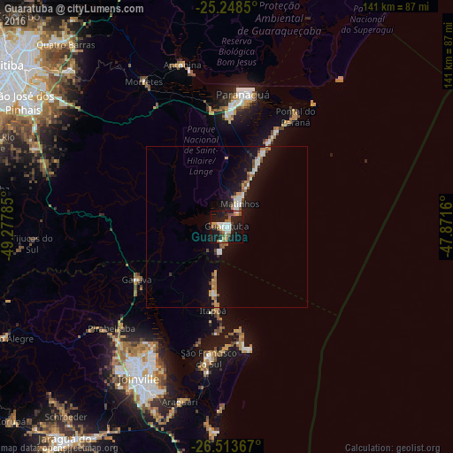
Analysis of Guaratuba night lights 2016
Square area 10x10 km:
 5.49%
5.49%90-99
5.87%80-89
2.84%70-79
4.73%60-69
4.36%50-59
5.68%40-49
4.36%30-39
1.52%20-29
6.63%10-19
47.73%0-9
10.8%Square area 50x50 km:
0.77%90-99
0.82%80-89
0.46%70-79
0.64%60-69
0.68%50-59
0.85%40-49
0.41%30-39
0.37%20-29
0.63%10-19
7.24%0-9
87.15%Clear (daylight) street map image can be seen on geolist.org.
Map coordinates:
25° 14' 54.6" South, 49° 16' 40.3" West
25° 52' 58" South, 48° 34' 29" West
26° 30' 49.2" South, 47° 52' 17.8" West
Some cities around Guaratuba sort by population:
• Joinville
54.1 km =33.6 mi,  209°
209°
• Paranaguá
41.1 km =25.5 mi,  6°
6°
• São José dos Pinhais
74.6 km =46.4 mi,  301°
301°
• Piraquara
69.6 km =43.2 mi,  314°
314°
• São Francisco do Sul
40.6 km =25.2 mi,  188°
188°
• Quatro Barras
76.4 km =47.5 mi,  318°
318°
• Antonina
52.3 km =32.5 mi,  344°
344°
• Pontal do Paraná
24.1 km =15 mi,  15°
15°
3461857 (p: 18,906)
Sources (retrieved 2019-11-25):
» Earth at Night: Flat Maps 2012, 2016