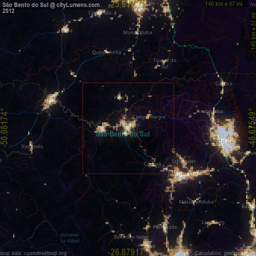
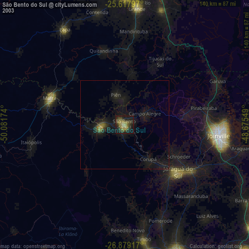
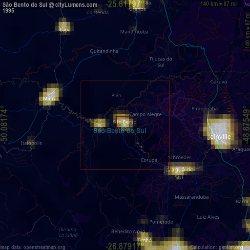
São Bento do Sul night lights from space
Night Light of São Bento do Sul (Santa Catarina) from space (Brazil) Src. Average luminocity for 10x10km area is 51.0972% and for 50x50km: 6.2352%.

Analysis of São Bento do Sul night lights 2016
Square area 10x10 km:
 6.35%
6.35%90-99
8.33%80-89
5.16%70-79
10.91%60-69
6.75%50-59
14.09%40-49
8.13%30-39
6.75%20-29
14.09%10-19
18.25%0-9
1.19%Square area 50x50 km:
0.39%90-99
0.54%80-89
0.47%70-79
1.25%60-69
0.88%50-59
1.54%40-49
0.8%30-39
1.02%20-29
1.33%10-19
5.57%0-9
86.21%Clear (daylight) street map image can be seen on geolist.org.
Map coordinates:
25° 37' 4.7" South, 50° 4' 54.3" West
26° 15' 1" South, 49° 22' 43" West
26° 52' 45" South, 48° 40' 31.8" West
Some cities around São Bento do Sul sort by population:
• Joinville
53.5 km =33.2 mi,  96°
96°
• Jaraguá do Sul
40.7 km =25.3 mi,  130°
130°
• Rio Negrinho
13.9 km =8.6 mi,  268°
268°
• Mafra
45.3 km =28.1 mi,  289°
289°
• Rio Negro
44.8 km =27.8 mi, 291°
• Guaramirim
44.9 km =27.9 mi,  123°
123°
• Schroeder
35.4 km =22 mi, 120°
• Corupá
23.7 km =14.7 mi,  145°
145°
3449350 (p: 77,597)
Sources (retrieved 2019-11-25):
» NASA, Earths city lights 1995
» NASA city lights 2003
» Earth at Night: Flat Maps 2012, 2016