Joaquim Nabuco night lights from space
Night Light of Joaquim Nabuco (Pernambuco) from space (Brazil) Src. Average luminocity for 10x10km area is 9.6694% and for 50x50km: 3.6269%.
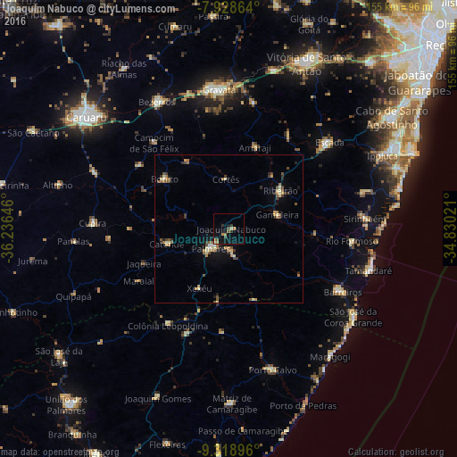
Analysis of Joaquim Nabuco night lights 2016
Square area 10x10 km:
 0%
0%90-99
1.24%80-89
0.41%70-79
0.83%60-69
3.31%50-59
1.03%40-49
1.86%30-39
2.07%20-29
0.83%10-19
10.54%0-9
77.89%Square area 50x50 km:
0.05%90-99
0.42%80-89
0.59%70-79
0.47%60-69
0.71%50-59
0.68%40-49
0.52%30-39
0.54%20-29
0.59%10-19
1.77%0-9
93.66%Clear (daylight) street map image can be seen on geolist.org.
Map coordinates:
7° 55' 43.1" South, 36° 14' 11.3" West
8° 37' 28" South, 35° 31' 60" West
9° 19' 8.3" South, 34° 49' 48.8" West
Some cities around Joaquim Nabuco sort by population:
• Palmares
9.2 km =5.7 mi,  224°
224°
• Ribeirão
21 km =13 mi,  54°
54°
• Catende
20.7 km =12.9 mi,  256°
256°
• Gameleira
16.7 km =10.4 mi,  74°
74°
• Amaraji
28.3 km =17.6 mi,  18°
18°
• Água Preta
9.2 km =5.7 mi,  178°
178°
• Guabiraba
27.4 km =17 mi,  327°
327°
• Bonito
27.5 km =17.1 mi,  308°
308°
3397262 (p: 9,965)
Sources (retrieved 2019-11-25):
» Earth at Night: Flat Maps 2012, 2016