Catende night lights from space
Night Light of Catende (Pernambuco) from space (Brazil) Src. Average luminocity for 10x10km area is 6.6715% and for 50x50km: 3.3273%.
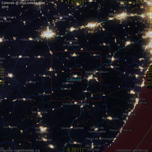
Analysis of Catende night lights 2016
Square area 10x10 km:
 0%
0%90-99
1.03%80-89
1.03%70-79
0.41%60-69
1.86%50-59
1.86%40-49
0.83%30-39
0.62%20-29
2.27%10-19
0%0-9
90.08%Square area 50x50 km:
0.05%90-99
0.39%80-89
0.45%70-79
0.32%60-69
0.93%50-59
0.6%40-49
0.44%30-39
0.51%20-29
0.55%10-19
1.62%0-9
94.14%Clear (daylight) street map image can be seen on geolist.org.
Map coordinates:
7° 58' 15.4" South, 36° 25' 11.3" West
8° 40' 0" South, 35° 43' 0" West
9° 21' 40" South, 35° 0' 48.8" West
Some cities around Catende sort by population:
• Palmares
13.9 km =8.6 mi,  97°
97°
• Cupira
26.2 km =16.3 mi,  282°
282°
• Água Preta
21 km =13 mi, 102°
• Maraial
16.4 km =10.2 mi,  218°
218°
• São Joaquim do Monte
27.8 km =17.3 mi,  339°
339°
• Colônia Leopoldina
26.9 km =16.7 mi,  181°
181°
• Joaquim Nabuco
20.7 km =12.9 mi,  76°
76°
• Bonito
21.9 km =13.6 mi,  356°
356°
3402528 (p: 23,322)
Sources (retrieved 2019-11-25):
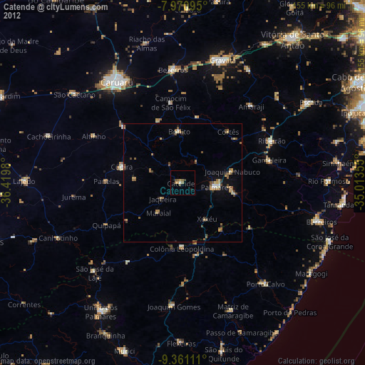
» Earth at Night: Flat Maps 2012, 2016