Itaberá night lights from space
Night Light of Itaberá (São Paulo) from space (Brazil) Src. Average luminocity for 10x10km area is 5.9702% and for 50x50km: 1.1728%.
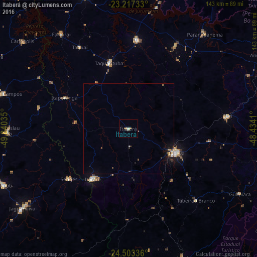
Analysis of Itaberá night lights 2016
Square area 10x10 km:
 0.6%
0.6%90-99
0.99%80-89
1.59%70-79
0.79%60-69
0.79%50-59
0.79%40-49
0%30-39
0.79%20-29
0%10-19
1.59%0-9
92.06%Square area 50x50 km:
0.11%90-99
0.12%80-89
0.09%70-79
0.19%60-69
0.12%50-59
0.2%40-49
0.15%30-39
0.23%20-29
0.22%10-19
0.77%0-9
97.81%Clear (daylight) street map image can be seen on geolist.org.
Map coordinates:
23° 13' 2.4" South, 49° 50' 25.3" West
23° 51' 43" South, 49° 8' 14" West
24° 30' 12.1" South, 48° 26' 2.8" West
Some cities around Itaberá sort by population:
• Itapeva
29.8 km =18.5 mi,  116°
116°
• Itararé
34.2 km =21.3 mi,  215°
215°
• Itaí
49.6 km =30.8 mi,  5°
5°
• Taquarituba
38.2 km =23.7 mi,  343°
343°
• Buri
55.8 km =34.7 mi,  82°
82°
• Sengés
43.3 km =26.9 mi,  229°
229°
• Itaporanga
39.8 km =24.7 mi,  295°
295°
• Ribeirão Branco
54.9 km =34.1 mi,  136°
136°
3460967 (p: 11,097)
Sources (retrieved 2019-11-25):
» Earth at Night: Flat Maps 2012, 2016