Itaporanga night lights from space
Night Light of Itaporanga (São Paulo) from space (Brazil) Src. Average luminocity for 10x10km area is 5.2421% and for 50x50km: 1.153%.
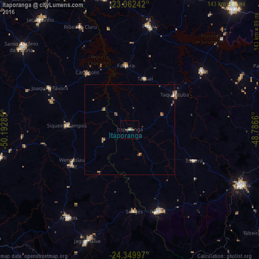
Analysis of Itaporanga night lights 2016
Square area 10x10 km:
 0%
0%90-99
0.79%80-89
0.79%70-79
0%60-69
1.79%50-59
1.98%40-49
0.99%30-39
0.79%20-29
0.79%10-19
0%0-9
92.06%Square area 50x50 km:
0.06%90-99
0.07%80-89
0.07%70-79
0.36%60-69
0.34%50-59
0.21%40-49
0.22%30-39
0.14%20-29
0.1%10-19
0.1%0-9
98.33%Clear (daylight) street map image can be seen on geolist.org.
Map coordinates:
23° 3' 44.7" South, 50° 11' 34.3" West
23° 42' 28" South, 49° 29' 23" West
24° 20' 59.9" South, 48° 47' 11.8" West
Some cities around Itaporanga sort by population:
• Itararé
47.8 km =29.7 mi,  160°
160°
• Itaí
51.9 km =32.2 mi,  51°
51°
• Taquarituba
31.7 km =19.7 mi, 52°
• Wenceslau Braz
36.8 km =22.9 mi,  239°
239°
• Sengés
45.2 km =28.1 mi,  176°
176°
• Siqueira Campos
35.1 km =21.8 mi,  273°
273°
• Fartura
35.6 km =22.1 mi,  356°
356°
• Itaberá
39.8 km =24.7 mi,  115°
115°
3460666 (p: 10,202)
Sources (retrieved 2019-11-25):
» Earth at Night: Flat Maps 2012, 2016