Buri night lights from space
Night Light of Buri (São Paulo) from space (Brazil) Src. Average luminocity for 10x10km area is 11.3294% and for 50x50km: 1.2535%.
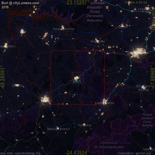
Analysis of Buri night lights 2016
Square area 10x10 km:
 0.79%
0.79%90-99
2.38%80-89
0.79%70-79
2.78%60-69
3.57%50-59
0.79%40-49
0%30-39
0.2%20-29
1.39%10-19
0%0-9
87.3%Square area 50x50 km:
0.12%90-99
0.17%80-89
0.05%70-79
0.26%60-69
0.32%50-59
0.15%40-49
0.05%30-39
0.14%20-29
0.26%10-19
0.24%0-9
98.25%Clear (daylight) street map image can be seen on geolist.org.
Map coordinates:
23° 9' 9.3" South, 49° 17' 45.3" West
23° 47' 51" South, 48° 35' 34" West
24° 26' 21.3" South, 47° 53' 22.8" West
Some cities around Buri sort by population:
• Itapetininga
59.5 km =37 mi,  67°
67°
• Itapeva
35.3 km =21.9 mi,  234°
234°
• Capâo Bonito
33.9 km =21.1 mi,  133°
133°
• Itaí
66 km =41 mi,  309°
309°
• Paranapanema
47.6 km =29.6 mi,  343°
343°
• Angatuba
38.8 km =24.1 mi,  28°
28°
• Itaberá
55.8 km =34.7 mi,  262°
262°
• Ribeirão Branco
50.2 km =31.2 mi,  200°
200°
3468802 (p: 15,958)
Sources (retrieved 2019-11-25):
» Earth at Night: Flat Maps 2012, 2016