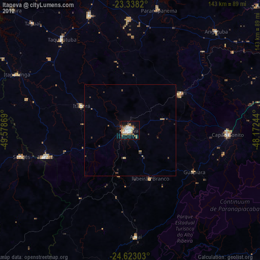
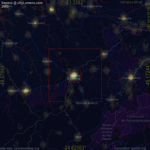
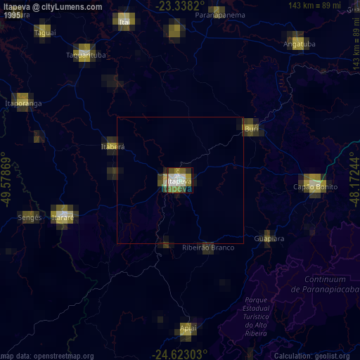
Itapeva night lights from space
Night Light of Itapeva (São Paulo) from space (Brazil) Src. Average luminocity for 10x10km area is 34.6042% and for 50x50km: 2.1709%.
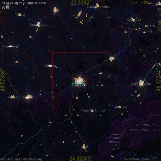
Analysis of Itapeva night lights 2016
Square area 10x10 km:
 5.87%
5.87%90-99
4.92%80-89
2.46%70-79
7.95%60-69
3.6%50-59
7.39%40-49
1.52%30-39
4.36%20-29
4.55%10-19
34.66%0-9
22.73%Square area 50x50 km:
0.26%90-99
0.22%80-89
0.12%70-79
0.42%60-69
0.29%50-59
0.4%40-49
0.14%30-39
0.37%20-29
0.46%10-19
1.77%0-9
95.55%Clear (daylight) street map image can be seen on geolist.org.
Map coordinates:
23° 20' 17.5" South, 49° 34' 43.3" West
23° 58' 56" South, 48° 52' 32" West
24° 37' 22.9" South, 48° 10' 20.8" West
Some cities around Itapeva sort by population:
• Itararé
48.5 km =30.1 mi,  252°
252°
• Capâo Bonito
53.5 km =33.2 mi,  92°
92°
• Taquarituba
62.5 km =38.8 mi,  323°
323°
• Apiaí
58.7 km =36.5 mi,  176°
176°
• Buri
35.3 km =21.9 mi,  54°
54°
• Sengés
61.4 km =38.2 mi,  256°
256°
• Itaberá
29.8 km =18.5 mi,  296°
296°
• Ribeirão Branco
28.8 km =17.9 mi,  157°
157°
3460723 (p: 62,957)
Sources (retrieved 2019-11-25):
» NASA, Earths city lights 1995
» NASA city lights 2003
» Earth at Night: Flat Maps 2012, 2016