Ipatinga night lights from space
Night Light of Ipatinga (Minas Gerais) from space (Brazil) Src. Average luminocity for 10x10km area is 74.2149% and for 50x50km: 10.5028%.
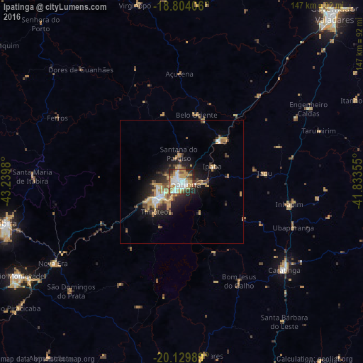
Analysis of Ipatinga night lights 2016
Square area 10x10 km:
 19.42%
90-99
18.39%80-89
11.16%70-79
20.45%60-69
3.72%50-59
5.17%40-49
5.99%30-39
6.4%20-29
8.06%10-19
1.24%0-9
0%Square area 50x50 km:
1.25%90-99
1.21%80-89
1.77%70-79
2.74%60-69
0.97%50-59
0.87%40-49
1.61%30-39
1.39%20-29
2.8%10-19
5.63%0-9
79.77%Clear (daylight) street map image can be seen on geolist.org.
Map coordinates:
18° 48' 14.6" South, 43° 14' 23.3" West
19° 28' 6" South, 42° 32' 12" West
20° 7' 47.6" South, 41° 50' 0.8" West
Some cities around Ipatinga sort by population:
• Coronel Fabriciano
11.2 km =7 mi,  239°
239°
• Timóteo
17.2 km =10.7 mi,  223°
223°
• Santana do Paraíso
12.1 km =7.5 mi,  343°
343°
• Belo Oriente
28.2 km =17.5 mi,  11°
11°
• Ipaba
13.7 km =8.5 mi,  63°
63°
• Açucena
44 km =27.3 mi,  358°
358°
• Inhapim
44.6 km =27.7 mi,  101°
101°
• Bom Jesus do Galho
46.3 km =28.8 mi,  150°
150°
3461144 (p: 228,746)
Sources (retrieved 2019-11-25):
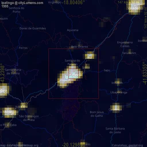
» NASA, Earths city lights 1995
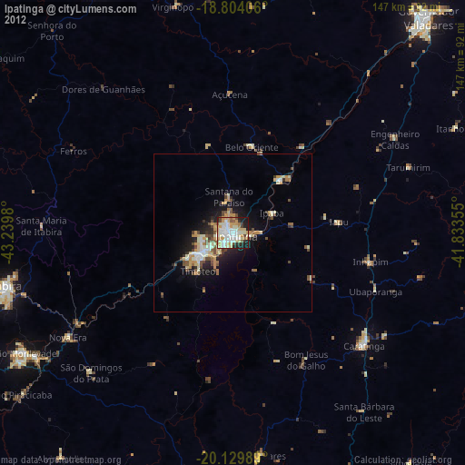
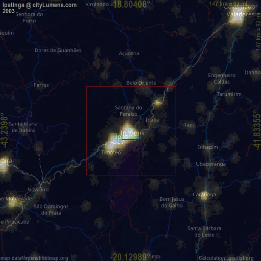
» NASA city lights 2003
» Earth at Night: Flat Maps 2012, 2016