Coronel Fabriciano night lights from space
Night Light of Coronel Fabriciano (Minas Gerais) from space (Brazil) Src. Average luminocity for 10x10km area is 67.374% and for 50x50km: 10.0139%.
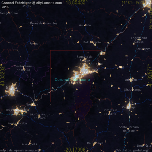
Analysis of Coronel Fabriciano night lights 2016
Square area 10x10 km:
 10.54%
90-99
10.12%80-89
18.18%70-79
20.66%60-69
7.44%50-59
5.99%40-49
5.99%30-39
7.64%20-29
9.3%10-19
4.13%0-9
0%Square area 50x50 km:
1.24%90-99
1.19%80-89
1.67%70-79
2.57%60-69
0.88%50-59
0.87%40-49
1.53%30-39
1.43%20-29
2.84%10-19
5.56%0-9
80.23%Clear (daylight) street map image can be seen on geolist.org.
Map coordinates:
18° 51' 16.4" South, 43° 19' 55.3" West
19° 31' 7" South, 42° 37' 44" West
20° 10' 47.9" South, 41° 55' 32.8" West
Some cities around Coronel Fabriciano sort by population:
• Ipatinga
11.2 km =7 mi,  59°
59°
• Timóteo
7.3 km =4.5 mi,  197°
197°
• Santana do Paraíso
18.4 km =11.4 mi,  20°
20°
• Belo Oriente
36.5 km =22.7 mi, 24°
• Ipaba
24.9 km =15.5 mi, 62°
• Nova Era
49.9 km =31 mi,  238°
238°
• Açucena
50.3 km =31.3 mi,  9°
9°
• Bom Jesus do Galho
47.6 km =29.6 mi,  136°
136°
3465476 (p: 100,916)
Sources (retrieved 2019-11-25):
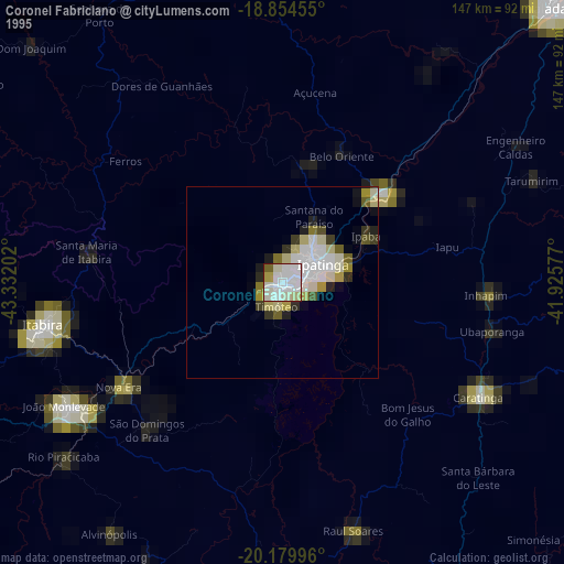
» NASA, Earths city lights 1995
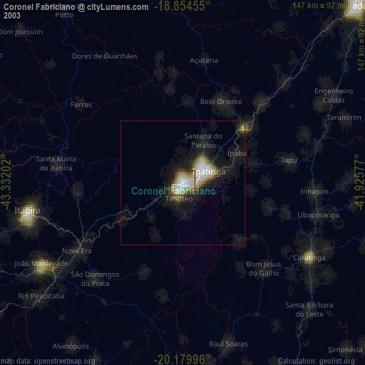
» NASA city lights 2003
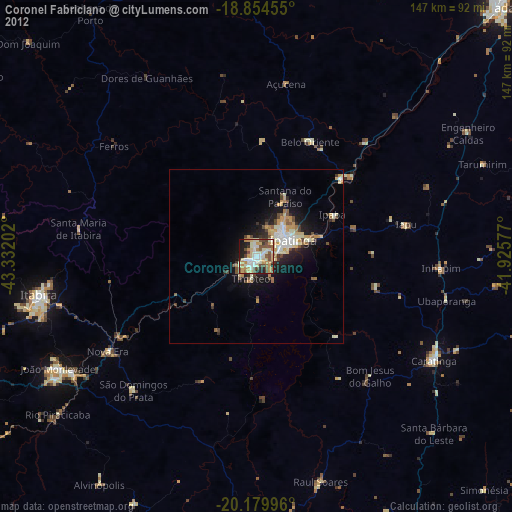
» Earth at Night: Flat Maps 2012, 2016