Elias Fausto night lights from space
Night Light of Elias Fausto (São Paulo) from space (Brazil) Src. Average luminocity for 10x10km area is 18.1448% and for 50x50km: 31.4375%.
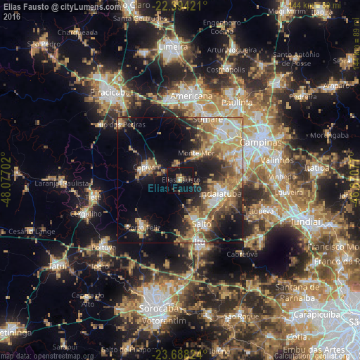
Analysis of Elias Fausto night lights 2016
Square area 10x10 km:
 0.6%
0.6%90-99
0.2%80-89
2.58%70-79
1.39%60-69
3.17%50-59
2.58%40-49
3.97%30-39
3.37%20-29
3.37%10-19
34.72%0-9
44.05%Square area 50x50 km:
3.93%90-99
4.3%80-89
5%70-79
6.77%60-69
5.38%50-59
4.44%40-49
4.31%30-39
4.4%20-29
6.43%10-19
15.15%0-9
39.89%Clear (daylight) street map image can be seen on geolist.org.
Map coordinates:
22° 23' 39.2" South, 48° 4' 37.3" West
23° 2' 34" South, 47° 22' 26" West
23° 41' 17.7" South, 46° 40' 14.8" West
Some cities around Elias Fausto sort by population:
• Sumaré
26.9 km =16.7 mi,  24°
24°
• Hortolândia
25.9 km =16.1 mi,  37°
37°
• Indaiatuba
17.3 km =10.7 mi,  107°
107°
• Itu
25.8 km =16 mi,  162°
162°
• Salto
19.7 km =12.2 mi,  153°
153°
• Porto Feliz
24.5 km =15.2 mi,  218°
218°
• Monte Mor
12.2 km =7.6 mi,  29°
29°
• Capivari
14.7 km =9.1 mi,  291°
291°
3464335 (p: 12,704)
Sources (retrieved 2019-11-25):
» Earth at Night: Flat Maps 2012, 2016