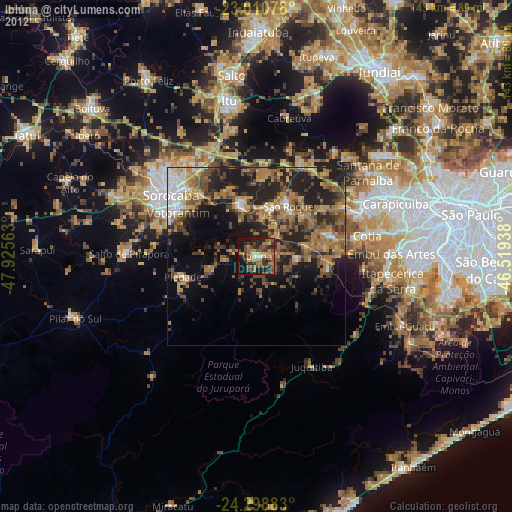
Ibiúna night lights from space
Night Light of Ibiúna (São Paulo) from space (Brazil) Src. Average luminocity for 10x10km area is 37.629% and for 50x50km: 26.3822%.
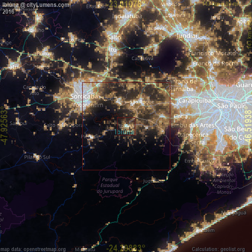
Analysis of Ibiúna night lights 2016
Square area 10x10 km:
 1.19%
1.19%90-99
2.78%80-89
0.79%70-79
6.55%60-69
8.33%50-59
10.71%40-49
10.32%30-39
14.88%20-29
15.48%10-19
25.6%0-9
3.37%Square area 50x50 km:
2.83%90-99
1.75%80-89
1.85%70-79
3.52%60-69
5%50-59
7.44%40-49
6.84%30-39
8.13%20-29
11.12%10-19
7.75%0-9
43.77%Clear (daylight) street map image can be seen on geolist.org.
Map coordinates:
23° 0' 38.8" South, 47° 55' 32.3" West
23° 39' 23" South, 47° 13' 21" West
24° 17' 55.8" South, 46° 31' 9.8" West
Some cities around Ibiúna sort by population:
• Sorocaba
29.5 km =18.3 mi,  305°
305°
• Itapevi
31.7 km =19.7 mi,  67°
67°
• Cotia
31.4 km =19.5 mi,  79°
79°
• Votorantim
25.1 km =15.6 mi,  299°
299°
• São Roque
16.7 km =10.4 mi,  32°
32°
• Mairinque
12.9 km =8 mi,  17°
17°
• Piedade
21.8 km =13.5 mi,  253°
253°
• Juquitiba
34.4 km =21.4 mi,  152°
152°
3461528 (p: 22,860)
Sources (retrieved 2019-11-25):
» Earth at Night: Flat Maps 2012, 2016