Itapevi night lights from space
Night Light of Itapevi (São Paulo) from space (Brazil) Src. Average luminocity for 10x10km area is 80.6766% and for 50x50km: 57.9645%.
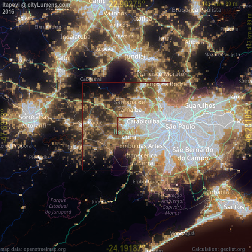
Analysis of Itapevi night lights 2016
Square area 10x10 km:
 25%
25%90-99
17.86%80-89
8.93%70-79
15.08%60-69
17.46%50-59
11.31%40-49
3.77%30-39
0.6%20-29
0%10-19
0%0-9
0%Square area 50x50 km:
18.04%90-99
7.95%80-89
5.23%70-79
9.21%60-69
9.98%50-59
10.3%40-49
7.68%30-39
6.36%20-29
8.27%10-19
5.88%0-9
11.1%Clear (daylight) street map image can be seen on geolist.org.
Map coordinates:
22° 54' 9.9" South, 47° 38' 14.3" West
23° 32' 56" South, 46° 56' 3" West
24° 11' 30.7" South, 46° 13' 51.8" West
Some cities around Itapevi sort by population:
• Osasco
14.6 km =9.1 mi,  82°
82°
• Carapicuíba
10.5 km =6.5 mi,  73°
73°
• Barueri
7.3 km =4.5 mi,  54°
54°
• Embu
13.9 km =8.6 mi,  143°
143°
• Taboão da Serra
16.9 km =10.5 mi,  120°
120°
• Cotia
6.3 km =3.9 mi,  165°
165°
• Jandira
4 km =2.5 mi, 53°
• Santana de Parnaíba
11.8 km =7.3 mi,  8°
8°
3460718 (p: 201,748)
Sources (retrieved 2019-11-25):
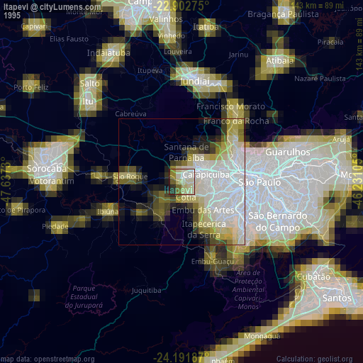
» NASA, Earths city lights 1995
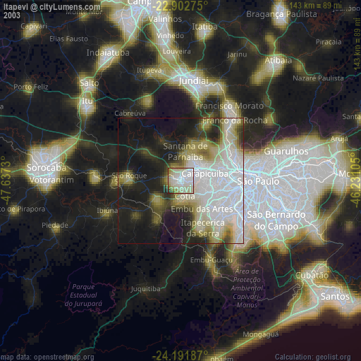
» NASA city lights 2003
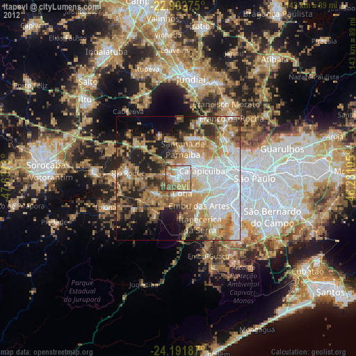
» Earth at Night: Flat Maps 2012, 2016