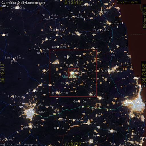
Guarabira night lights from space
Night Light of Guarabira (Paraíba) from space (Brazil) Src. Average luminocity for 10x10km area is 44.355% and for 50x50km: 8.7552%.
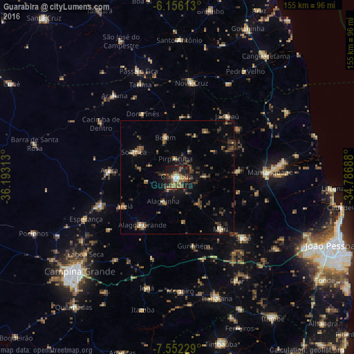
Analysis of Guarabira night lights 2016
Square area 10x10 km:
 4.11%
4.11%90-99
3.46%80-89
4.33%70-79
8.44%60-69
11.69%50-59
12.99%40-49
4.11%30-39
10.17%20-29
10.82%10-19
29%0-9
0.87%Square area 50x50 km:
0.19%90-99
0.48%80-89
0.81%70-79
0.88%60-69
1.45%50-59
2.01%40-49
1.91%30-39
2.5%20-29
2.64%10-19
5.07%0-9
82.06%Clear (daylight) street map image can be seen on geolist.org.
Map coordinates:
6° 9' 22.1" South, 36° 11' 35.3" West
6° 51' 17" South, 35° 29' 24" West
7° 33' 8.2" South, 34° 47' 12.8" West
Some cities around Guarabira sort by population:
• Mari
29.6 km =18.4 mi,  140°
140°
• Solânea
12.4 km =7.7 mi,  333°
333°
• Belém
18.8 km =11.7 mi,  345°
345°
• Areia
25.3 km =15.7 mi,  241°
241°
• Pirpirituba
8.4 km =5.2 mi, 353°
• Arara
29.8 km =18.5 mi,  275°
275°
• Alagoinha
12.2 km =7.6 mi,  209°
209°
• Bananeiras
19.6 km =12.2 mi,  306°
306°
3398570 (p: 43,749)
Sources (retrieved 2019-11-25):
» Earth at Night: Flat Maps 2012, 2016