Cláudio night lights from space
Night Light of Cláudio (Minas Gerais) from space (Brazil) Src. Average luminocity for 10x10km area is 12.9318% and for 50x50km: 2.0066%.
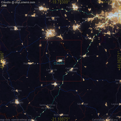
Analysis of Cláudio night lights 2016
Square area 10x10 km:
 0.95%
0.95%90-99
2.08%80-89
1.14%70-79
3.6%60-69
2.84%50-59
0%40-49
1.7%30-39
1.52%20-29
0.57%10-19
1.7%0-9
83.9%Square area 50x50 km:
0.07%90-99
0.15%80-89
0.14%70-79
0.6%60-69
0.29%50-59
0.16%40-49
0.43%30-39
0.38%20-29
0.3%10-19
0.3%0-9
97.18%Clear (daylight) street map image can be seen on geolist.org.
Map coordinates:
19° 46' 59.1" South, 45° 28' 8.3" West
20° 26' 36" South, 44° 45' 57" West
21° 6' 2.7" South, 44° 3' 45.8" West
Some cities around Cláudio sort by population:
• Divinópolis
35.8 km =22.2 mi,  338°
338°
• Itaúna
45.4 km =28.2 mi,  25°
25°
• Oliveira
28.9 km =18 mi,  192°
192°
• Mateus Leme
61.9 km =38.5 mi, 34°
• Igarapé
63.8 km =39.6 mi,  49°
49°
• Santo Antônio do Amparo
58.2 km =36.2 mi,  195°
195°
• Itapecerica
37.6 km =23.4 mi,  265°
265°
• Carmo do Cajuru
28.8 km =17.9 mi,  358°
358°
3466062 (p: 21,824)
Sources (retrieved 2019-11-25):
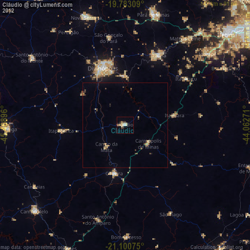
» Earth at Night: Flat Maps 2012, 2016