Chavantes night lights from space
Night Light of Chavantes (São Paulo) from space (Brazil) Src. Average luminocity for 10x10km area is 7.4365% and for 50x50km: 6.545%.
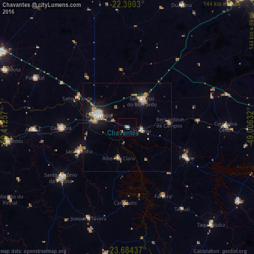
Analysis of Chavantes night lights 2016
Square area 10x10 km:
 0.6%
0.6%90-99
0.99%80-89
0%70-79
0.79%60-69
2.58%50-59
0.6%40-49
1.79%30-39
0.6%20-29
0.79%10-19
0.6%0-9
90.67%Square area 50x50 km:
0.71%90-99
0.84%80-89
0.41%70-79
1.18%60-69
1.4%50-59
0.72%40-49
0.76%30-39
0.63%20-29
1.07%10-19
4.78%0-9
87.5%Clear (daylight) street map image can be seen on geolist.org.
Map coordinates:
22° 23' 25.1" South, 50° 24' 45.3" West
23° 2' 20" South, 49° 42' 34" West
23° 41' 3.7" South, 49° 0' 22.8" West
Some cities around Chavantes sort by population:
• Ourinhos
17.8 km =11.1 mi,  292°
292°
• Santa Cruz do Rio Pardo
17.4 km =10.8 mi,  26°
26°
• Jacarezinho
29.8 km =18.5 mi,  243°
243°
• Piraju
37.5 km =23.3 mi,  117°
117°
• Cambará
37.3 km =23.2 mi,  268°
268°
• Fartura
43.9 km =27.3 mi,  152°
152°
• Ipauçu
8.7 km =5.4 mi,  103°
103°
• Bernardino de Campos
24.2 km =15 mi,  83°
83°
3444843 (p: 10,306)
Sources (retrieved 2019-11-25):
» Earth at Night: Flat Maps 2012, 2016