Bernardino de Campos night lights from space
Night Light of Bernardino de Campos (São Paulo) from space (Brazil) Src. Average luminocity for 10x10km area is 5.7778% and for 50x50km: 3.8268%.
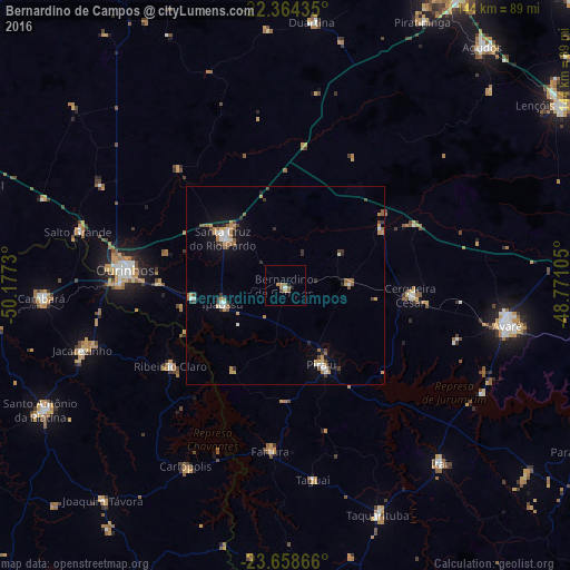
Analysis of Bernardino de Campos night lights 2016
Square area 10x10 km:
 0.2%
0.2%90-99
0.6%80-89
0.79%70-79
0%60-69
2.78%50-59
1.98%40-49
0%30-39
0.79%20-29
0.79%10-19
0.79%0-9
91.27%Square area 50x50 km:
0.35%90-99
0.54%80-89
0.21%70-79
0.74%60-69
0.68%50-59
0.63%40-49
0.44%30-39
0.58%20-29
0.42%10-19
1.59%0-9
93.83%Clear (daylight) street map image can be seen on geolist.org.
Map coordinates:
22° 21' 51.7" South, 50° 10' 38.3" West
23° 0' 47" South, 49° 28' 27" West
23° 39' 31.2" South, 48° 46' 15.8" West
Some cities around Bernardino de Campos sort by population:
• Ourinhos
40.7 km =25.3 mi,  275°
275°
• Santa Cruz do Rio Pardo
20.6 km =12.8 mi,  308°
308°
• Jacarezinho
53.2 km =33.1 mi,  252°
252°
• Piraju
22.1 km =13.7 mi,  155°
155°
• Cerqueira César
31.6 km =19.6 mi,  94°
94°
• Fartura
41.9 km =26 mi,  185°
185°
• Ipauçu
16.3 km =10.1 mi, 252°
• Chavantes
24.2 km =15 mi,  263°
263°
3470059 (p: 9,342)
Sources (retrieved 2019-11-25):
» Earth at Night: Flat Maps 2012, 2016