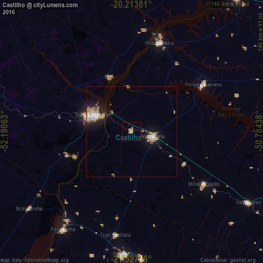
Castilho night lights from space
Night Light of Castilho (São Paulo) from space (Brazil) Src. Average luminocity for 10x10km area is 8.2857% and for 50x50km: 5.0984%.
Analysis of Castilho night lights 2016
Square area 10x10 km:
 0.4%
0.4%90-99
0.4%80-89
1.19%70-79
3.97%60-69
1.19%50-59
0.79%40-49
0%30-39
0%20-29
0.4%10-19
0.4%0-9
91.27%Square area 50x50 km:
0.69%90-99
0.84%80-89
0.37%70-79
1.18%60-69
0.77%50-59
0.37%40-49
0.66%30-39
0.36%20-29
0.89%10-19
3.85%0-9
90.02%Clear (daylight) street map image can be seen on geolist.org.
Map coordinates:
20° 12' 49.7" South, 52° 11' 26.3" West
20° 52' 20" South, 51° 29' 15" West
21° 31' 39.9" South, 50° 47' 3.8" West
Some cities around Castilho sort by population:
• Três Lagoas
24.3 km =15.1 mi,  292°
292°
• Andradina
11.5 km =7.1 mi,  103°
103°
• Ilha Solteira
51.1 km =31.8 mi,  17°
17°
• Mirandopólis
49.5 km =30.8 mi,  125°
125°
• Pereira Barreto
47.2 km =29.3 mi,  56°
56°
• Panorama
66.2 km =41.1 mi,  215°
215°
• Junqueirópolis
71.7 km =44.6 mi,  175°
175°
• Tupi Paulista
57.2 km =35.5 mi,  188°
188°
3466708 (p: 11,419)
Sources (retrieved 2019-11-25):
» Earth at Night: Flat Maps 2012, 2016