Botelhos night lights from space
Night Light of Botelhos (Minas Gerais) from space (Brazil) Src. Average luminocity for 10x10km area is 4.1818% and for 50x50km: 4.1561%.
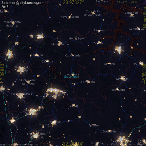
Analysis of Botelhos night lights 2016
Square area 10x10 km:
 0%
0%90-99
0%80-89
1.33%70-79
1.7%60-69
0.76%50-59
0.57%40-49
0.95%30-39
0%20-29
0%10-19
0%0-9
94.7%Square area 50x50 km:
0.47%90-99
0.45%80-89
0.5%70-79
0.74%60-69
0.84%50-59
0.59%40-49
0.37%30-39
0.65%20-29
1.4%10-19
2.88%0-9
91.11%Clear (daylight) street map image can be seen on geolist.org.
Map coordinates:
20° 58' 41.8" South, 47° 5' 53.3" West
21° 37' 60" South, 46° 23' 42" West
22° 17' 7.6" South, 45° 41' 30.8" West
Some cities around Botelhos sort by population:
• Poços de Caldas
24.3 km =15.1 mi,  225°
225°
• Guaxupé
49.1 km =30.5 mi,  317°
317°
• Machado
49.3 km =30.6 mi,  95°
95°
• Muzambinho
31.7 km =19.7 mi,  334°
334°
• Caconde
28.2 km =17.5 mi,  294°
294°
• Campestre
17.6 km =10.9 mi,  119°
119°
• Areado
40 km =24.9 mi,  40°
40°
• Alterosa
50 km =31.1 mi,  31°
31°
3469140 (p: 11,072)
Sources (retrieved 2019-11-25):
» Earth at Night: Flat Maps 2012, 2016