Campestre night lights from space
Night Light of Campestre (Minas Gerais) from space (Brazil) Src. Average luminocity for 10x10km area is 5.0455% and for 50x50km: 1.0173%.
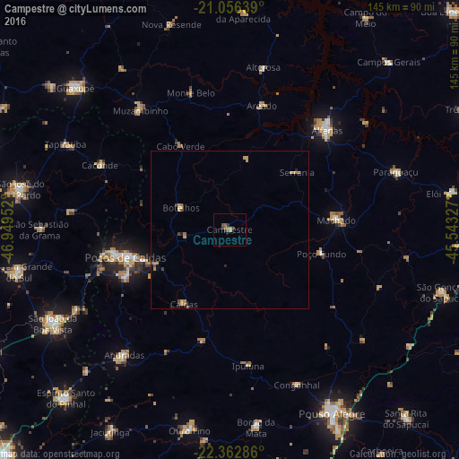
Analysis of Campestre night lights 2016
Square area 10x10 km:
 0%
0%90-99
0%80-89
0%70-79
1.33%60-69
1.7%50-59
1.7%40-49
0.95%30-39
1.7%20-29
0.95%10-19
0%0-9
91.67%Square area 50x50 km:
0%90-99
0%80-89
0.13%70-79
0.42%60-69
0.29%50-59
0.16%40-49
0.15%30-39
0.12%20-29
0.14%10-19
0.14%0-9
98.45%Clear (daylight) street map image can be seen on geolist.org.
Map coordinates:
21° 3' 23" South, 46° 56' 58.3" West
21° 42' 40" South, 46° 14' 47" West
22° 21' 46.3" South, 45° 32' 35.8" West
Some cities around Campestre sort by population:
• Poços de Caldas
33.6 km =20.9 mi,  255°
255°
• Alfenas
44 km =27.3 mi,  44°
44°
• Machado
34 km =21.1 mi,  83°
83°
• Andradas
51.8 km =32.2 mi,  219°
219°
• Muzambinho
47.2 km =29.3 mi,  322°
322°
• Caconde
45.8 km =28.5 mi,  296°
296°
• Botelhos
17.6 km =10.9 mi, 299°
• Areado
40.6 km =25.2 mi,  14°
14°
3467908 (p: 11,802)
Sources (retrieved 2019-11-25):
» Earth at Night: Flat Maps 2012, 2016