Birigui night lights from space
Night Light of Birigui (São Paulo) from space (Brazil) Src. Average luminocity for 10x10km area is 47.0246% and for 50x50km: 8.4087%.
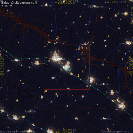
Analysis of Birigui night lights 2016
Square area 10x10 km:
 9.28%
9.28%90-99
10.42%80-89
4.36%70-79
10.23%60-69
6.25%50-59
0.38%40-49
3.03%30-39
5.68%20-29
17.23%10-19
32.01%0-9
1.14%Square area 50x50 km:
1.15%90-99
1.25%80-89
0.56%70-79
1.46%60-69
1.28%50-59
0.35%40-49
1.53%30-39
1.21%20-29
2.23%10-19
7.06%0-9
81.92%Clear (daylight) street map image can be seen on geolist.org.
Map coordinates:
20° 37' 55.3" South, 51° 2' 35.3" West
21° 17' 19" South, 50° 20' 24" West
21° 56' 32.2" South, 49° 38' 12.8" West
Some cities around Birigui sort by population:
• Araçatuba
13.1 km =8.1 mi,  312°
312°
• Penápolis
30.8 km =19.1 mi,  118°
118°
• Guararapes
31.5 km =19.6 mi,  275°
275°
• Promissão
57 km =35.4 mi, 118°
• Valparaíso
55.2 km =34.3 mi, 277°
• Buritama
31.8 km =19.8 mi,  38°
38°
• Auriflama
70.7 km =43.9 mi,  341°
341°
• General Salgado
71.2 km =44.2 mi,  358°
358°
3469989 (p: 102,277)
Sources (retrieved 2019-11-25):
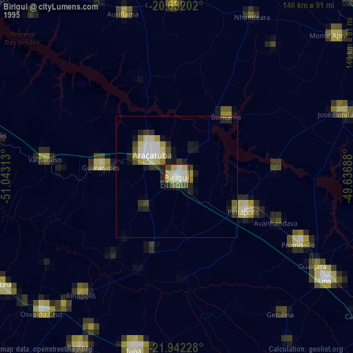
» NASA, Earths city lights 1995
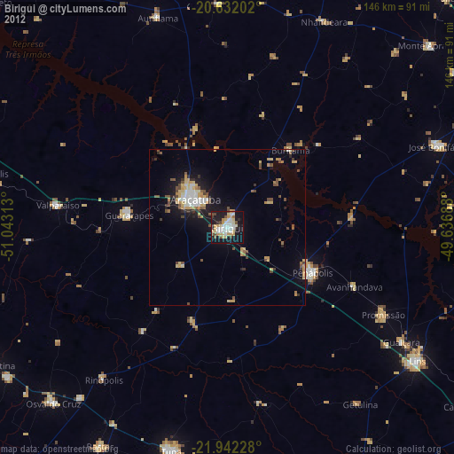
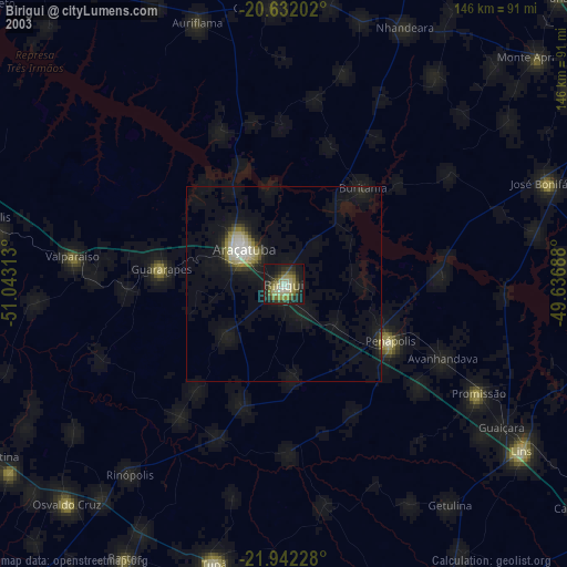
» NASA city lights 2003
» Earth at Night: Flat Maps 2012, 2016