Baixo Guandu night lights from space
Night Light of Baixo Guandu (Espírito Santo) from space (Brazil) Src. Average luminocity for 10x10km area is 23.7314% and for 50x50km: 2.0629%.
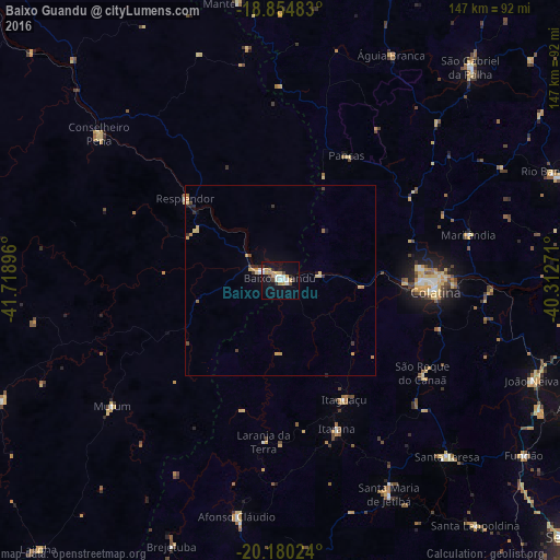
Analysis of Baixo Guandu night lights 2016
Square area 10x10 km:
 4.75%
4.75%90-99
3.51%80-89
1.86%70-79
6.2%60-69
1.65%50-59
0.21%40-49
2.27%30-39
1.24%20-29
4.13%10-19
24.38%0-9
49.79%Square area 50x50 km:
0.22%90-99
0.17%80-89
0.35%70-79
0.58%60-69
0.16%50-59
0.07%40-49
0.23%30-39
0.25%20-29
0.36%10-19
1.28%0-9
96.32%Clear (daylight) street map image can be seen on geolist.org.
Map coordinates:
18° 51' 17.4" South, 41° 43' 8.3" West
19° 31' 8" South, 41° 0' 57" West
20° 10' 48.9" South, 40° 18' 45.8" West
Some cities around Baixo Guandu sort by population:
• Colatina
40.4 km =25.1 mi,  93°
93°
• Aimorés
5.7 km =3.5 mi,  296°
296°
• Resplendor
33.1 km =20.6 mi,  310°
310°
• Afonso Cláudio
62.8 km =39 mi,  190°
190°
• Conselheiro Pena
61.5 km =38.2 mi, 308°
• Mutum
54.2 km =33.7 mi,  234°
234°
• Itaguaçu
35.7 km =22.2 mi,  151°
151°
• Pancas
37 km =23 mi,  27°
27°
3471061 (p: 19,292)
Sources (retrieved 2019-11-25):
» Earth at Night: Flat Maps 2012, 2016