Colatina night lights from space
Night Light of Colatina (Espírito Santo) from space (Brazil) Src. Average luminocity for 10x10km area is 55.9504% and for 50x50km: 4.8408%.
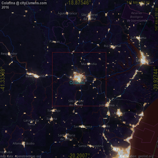

Analysis of Colatina night lights 2016
Square area 10x10 km:
 7.85%
7.85%90-99
7.02%80-89
19.83%70-79
10.54%60-69
5.79%50-59
3.72%40-49
9.5%30-39
5.58%20-29
6.4%10-19
21.9%0-9
1.86%Square area 50x50 km:
0.35%90-99
0.35%80-89
1.18%70-79
0.85%60-69
0.58%50-59
0.49%40-49
1.06%30-39
0.58%20-29
0.89%10-19
3.34%0-9
90.33%Clear (daylight) street map image can be seen on geolist.org.
Map coordinates:
18° 52' 31.7" South, 41° 20' 1.3" West
19° 32' 22" South, 40° 37' 50" West
20° 12' 2.5" South, 39° 55' 38.8" West
Some cities around Colatina sort by population:
• Aracruz
48.7 km =30.3 mi,  129°
129°
• Baixo Guandu
40.4 km =25.1 mi,  273°
273°
• Aimorés
45.7 km =28.4 mi,  276°
276°
• João Neiva
35.3 km =21.9 mi, 133°
• Santa Teresa
44.2 km =27.5 mi,  175°
175°
• Ibiraçu
42.5 km =26.4 mi,  139°
139°
• Itaguaçu
37.5 km =23.3 mi,  218°
218°
• Pancas
41.9 km =26 mi,  326°
326°
3465944 (p: 101,190)
Sources (retrieved 2019-11-25):
» NASA, Earths city lights 1995
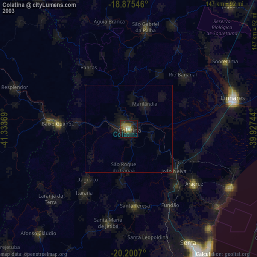
» NASA city lights 2003
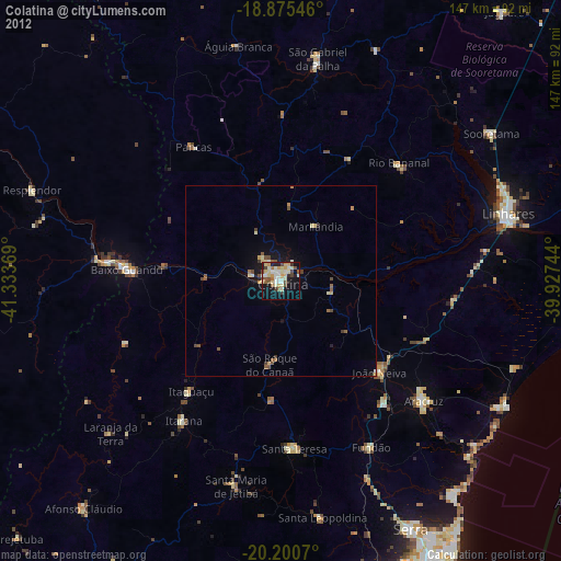
» Earth at Night: Flat Maps 2012, 2016