Resplendor night lights from space
Night Light of Resplendor (Minas Gerais) from space (Brazil) Src. Average luminocity for 10x10km area is 6.0599% and for 50x50km: 1.7419%.
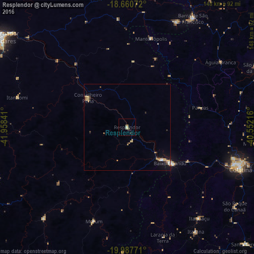
Analysis of Resplendor night lights 2016
Square area 10x10 km:
 0%
0%90-99
0.83%80-89
1.65%70-79
0.83%60-69
1.24%50-59
0.41%40-49
0.62%30-39
0.41%20-29
2.27%10-19
2.27%0-9
89.46%Square area 50x50 km:
0.11%90-99
0.15%80-89
0.33%70-79
0.55%60-69
0.2%50-59
0.08%40-49
0.13%30-39
0.2%20-29
0.37%10-19
1.03%0-9
96.84%Clear (daylight) street map image can be seen on geolist.org.
Map coordinates:
18° 39' 38.6" South, 41° 57' 30.3" West
19° 19' 32" South, 41° 15' 19" West
19° 59' 15.8" South, 40° 33' 7.8" West
Some cities around Resplendor sort by population:
• Baixo Guandu
33.1 km =20.6 mi,  130°
130°
• Aimorés
27.6 km =17.1 mi, 133°
• Conselheiro Pena
28.4 km =17.6 mi,  306°
306°
• Mutum
56.1 km =34.9 mi,  199°
199°
• Divino das Laranjeiras
65.3 km =40.6 mi,  338°
338°
• Mantenópolis
53.3 km =33.1 mi,  15°
15°
• Itaguaçu
67.5 km =41.9 mi,  141°
141°
• Pancas
43.8 km =27.2 mi,  75°
75°
3451650 (p: 15,131)
Sources (retrieved 2019-11-25):
» Earth at Night: Flat Maps 2012, 2016