Aquiraz night lights from space
Night Light of Aquiraz (Ceará) from space (Brazil) Src. Average luminocity for 10x10km area is 70.8312% and for 50x50km: 40.9061%.
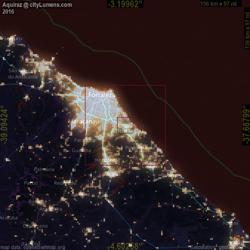
Analysis of Aquiraz night lights 2016
Square area 10x10 km:
 5.41%
5.41%90-99
23.38%80-89
11.47%70-79
10.39%60-69
18.61%50-59
14.5%40-49
5.19%30-39
3.9%20-29
6.49%10-19
0.65%0-9
0%Square area 50x50 km:
12.16%90-99
9.48%80-89
3.81%70-79
3.64%60-69
4.68%50-59
5.63%40-49
3.82%30-39
4.74%20-29
9.21%10-19
11.54%0-9
31.28%Clear (daylight) street map image can be seen on geolist.org.
Map coordinates:
3° 11' 58.6" South, 39° 5' 39.3" West
3° 54' 5" South, 38° 23' 28" West
4° 36' 9.3" South, 37° 41' 16.8" West
Some cities around Aquiraz sort by population:
• Fortaleza
26.5 km =16.5 mi,  320°
320°
• Maracanaú
26.2 km =16.3 mi,  276°
276°
• Pacatuba
27 km =16.8 mi,  250°
250°
• Cascavel
30.6 km =19 mi,  147°
147°
• Horizonte
24.3 km =15.1 mi,  204°
204°
• Pacajus
31.1 km =19.3 mi,  194°
194°
• Eusébio
6.7 km =4.2 mi, 280°
• Itaitinga
17 km =10.6 mi,  243°
243°
3407407 (p: 65,116)
Sources (retrieved 2019-11-25):
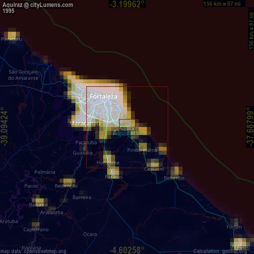
» NASA, Earths city lights 1995
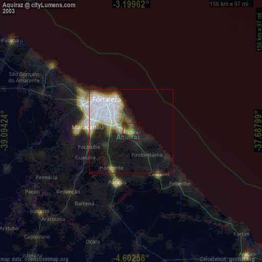
» NASA city lights 2003
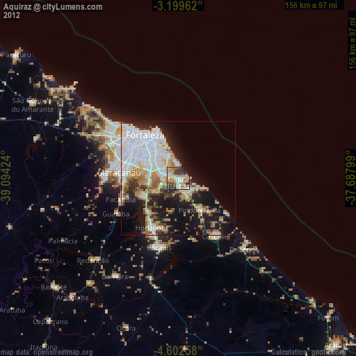
» Earth at Night: Flat Maps 2012, 2016